A winter weather advisory is in effect today for the N. Valley with a mix of frz. rain, sleet and snow this afternoon. The rest of us will see scattered showers with temps in the S. Valley making it into the 50s before temps fall this afternoon as winds ramp up out of the north around 15-30 mph.
A second storm system will move to our south on Saturday bringing snow to SD into MN. The F/M area will be right on the northern end of that system bringing us some light snow Saturday afternoon into Saturday night. Less than 1″ expected in the F/M area with slightly higher amounts from about Wahpeton to Wadena and points south of there.
Temps will remain in the 30s through the weekend into early next week. We have the potential for more snow coming into the area Tuesday/Wednesday next week and that storm may hold a little more “punch” to it. Here’s a look at 3 of our models and their prediction of snowfall next Tue/Wed:
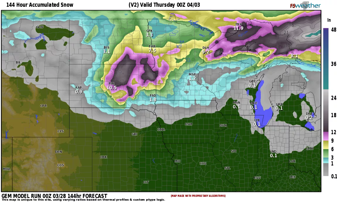
Courtesy: F5 weather
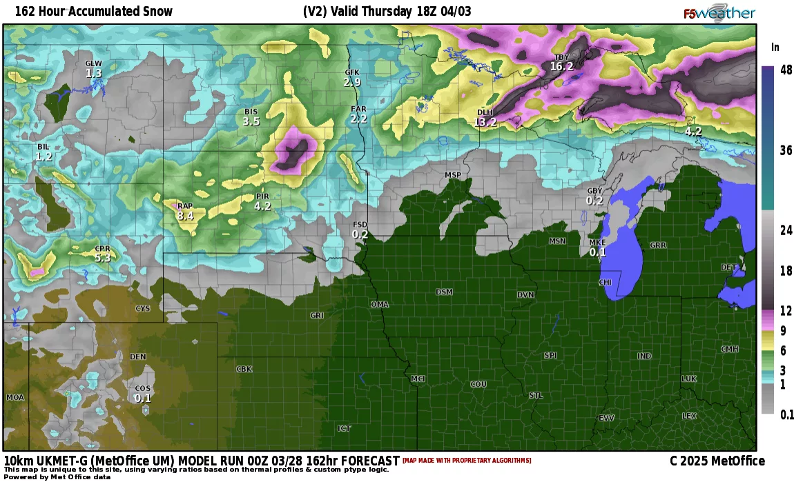
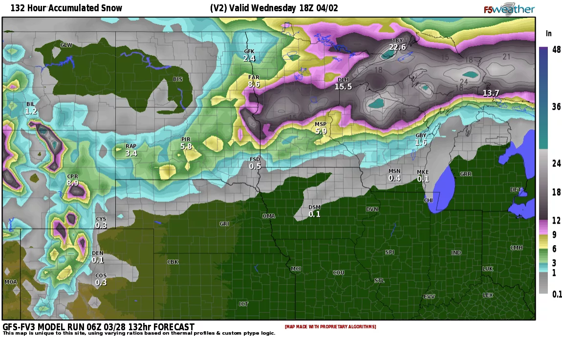
Now….keep in mind that models tend to over predict snowfall amounts. Even if we cut these amounts in half we still have more accumulating snow expected next Tue/Wed. Stay tuned…..