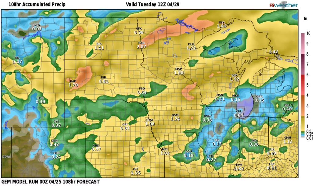
Today will be a top 10 day for sure with LIGHT WINDS and sunny skies. A great combination with temps in the 60s!! Enjoy because wind, clouds and rain come back into the forecast for the weekend into Monday. Now, don’t let that deter any outdoor plans for the weekend. We WILL have many dry hours mixed in with only an ISOLATED shower both Sat/Sun with the main rain coming in Sunday night into Monday. Here’s a look at 4 of our models predictions:
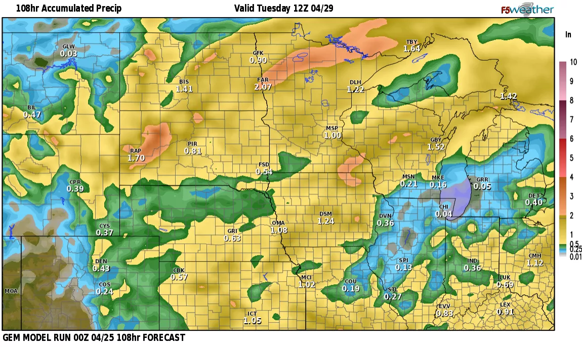
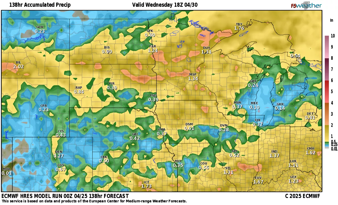
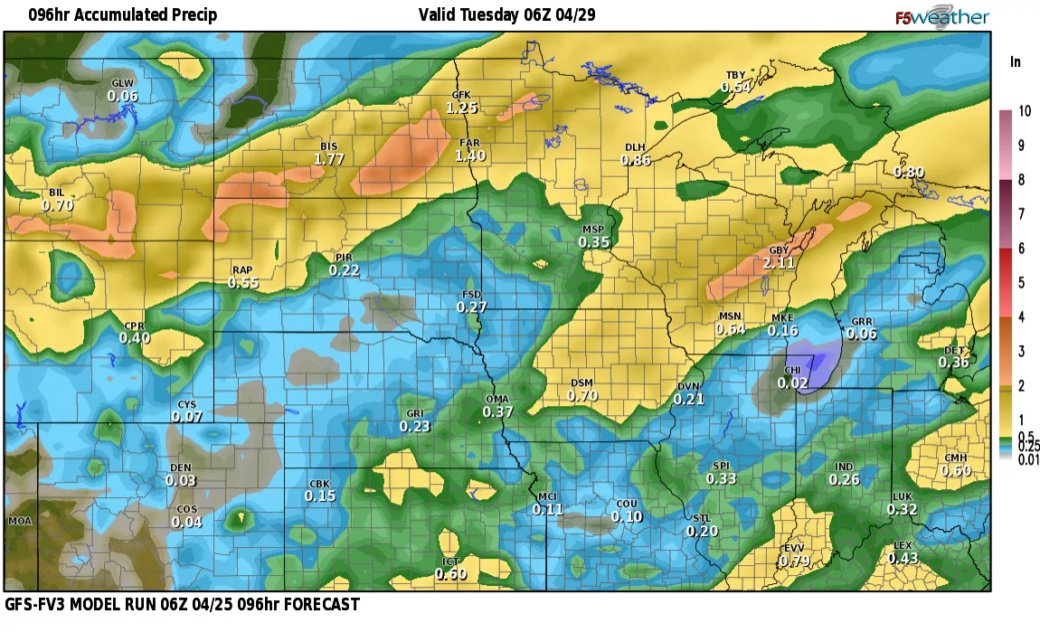
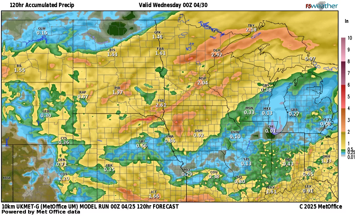
Most of our models are giving the F/M area over 1″ of rain which is good news for most. Now, with the rain, it looks like a decent chance for T’storms and some of those could be strong/severe on Monday from the Valley eastward. Here’s a look at SPC (Storm Prediction Center) outlook for Monday with a slight chance for severe weather in parts of the area:

Courtesy SPC
Although I believe the best chance for severe weather lies to our SE, we could see some hail producing storms on Monday. Stay tuned…..