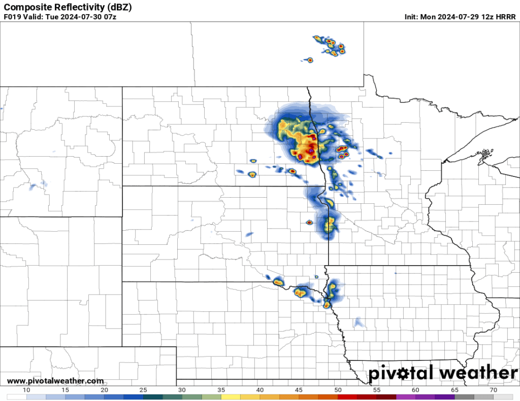
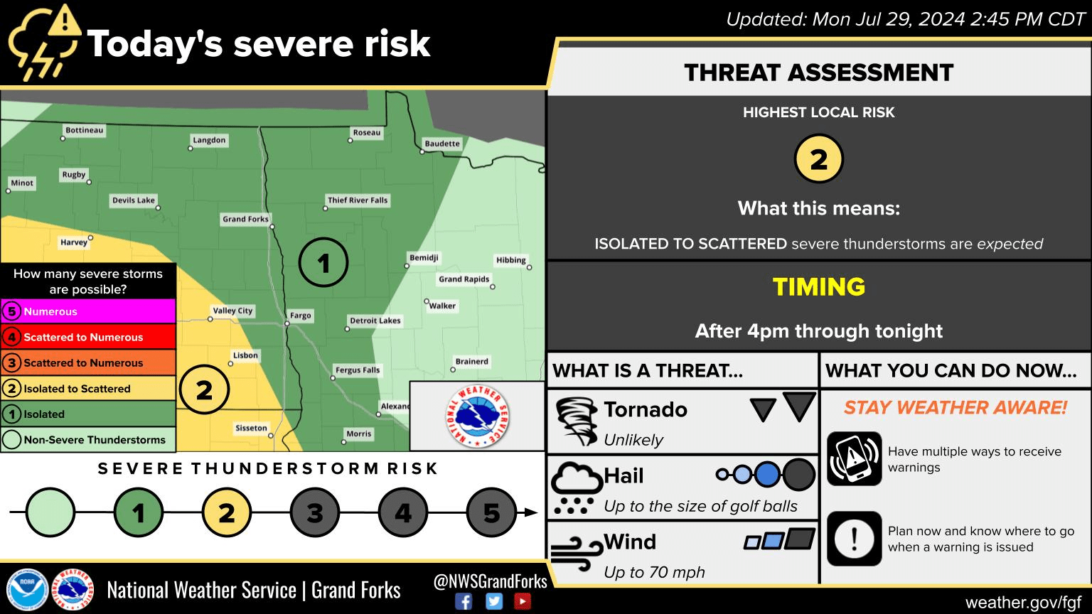
Another three day window of strong storm potential is in the forecast for the area. A slight risk (level 2 of 5) and marginal risk (level 1 of 5) for severe weather have been issued for portions of North Dakota, South Dakota, and Minnesota. The main threat will be wind and hail although an isolated tornado will be possible (favoring south-central ND and SD). Storms will initiate west of the Red River Valley through the later afternoon and evening in Western North Dakota and push into Central ND through the evening then Eastern North Dakota after dark and overnight. The main tornado threat will be through the evening hours while storms remain more singular and turn more into a wind threat as they track into Valley and Minnesota after midnight. As storms move into Minnesota, storms should be losing some of their strength and becoming more of a 60+ mph wind gust threat.
A second marginal and slight risk has been issued for Tuesday, mainly through the overnight hours in Eastern ND and MN (Late afternoon and evening out west). The main threat of the Tuesday night storms will be wind gusts of 60+ mph and one-inch hail. Storms will likely begin in portions of Central ND Tuesday evening and push into Central MN Tuesday night.
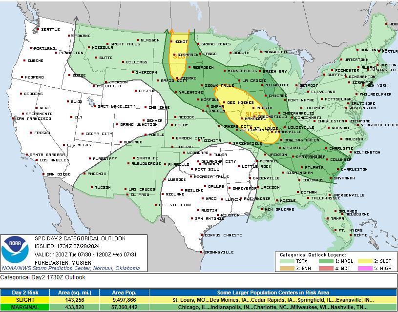
SPC Day Two Severe Weather Risk issued 7/29/24 via SPC
Wednesday brings us to the third marginal risk that has been issued. A few thunderstorms will be possible Wednesday that may be on the strong side.
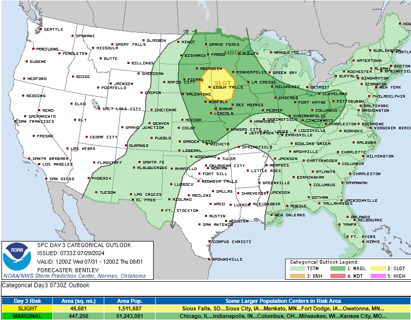
SPC Day Three Severe Weather Risk issued 7/29/24 via SPC
Meteorologist,
Justin Storm