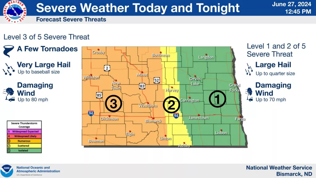
Strong and severe storms are expected to develop and track through western North Dakota this late afternoon and evening. Damaging wind gusts, large hail, and a few tornadoes will be possible. Through the evening hours into early tonight, storms will become more of a line of storms and track into Central North Dakota and then into Eastern North Dakota overnight.
Timing on storms hitting the Red River Valley looks to be after midnight favoring closer to the 1:00 AM time frame. There will likely be other storms that develop in front of that line of storms after 9:00/10:00 PM this evening that could be strong. The main concern for severe weather this late evening and tonight will be quarter-size hail and 60 mph wind gusts. As Storms move into Eastern North Dakota and the Red River Valley, they will be in a weakening phase. The worst storms will be in western North Dakota this afternoon and evening.
There is potential for a few storms to develop in Minnesota Friday afternoon/evening and in North Dakota Friday Evening.