As heat and moisture build at the surface Sunday a lot of potential energy for storms to tap into is going to be produced!
Through Sunday hot and humid conditions are expected to bring heat indexes upwards of 100+ degrees, Heat Advisories have been issued for Sunday. With hot and humid air comes the potential for storms to develop. A cap will likely be set in place through the day that should hold off any storm formation through the day, but it will remain possible to see some storms develop through the late afternoon and evening within the area if there is a weak spot in the cap. What is a CAP? Check out my previous article explaining a cap.
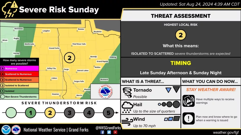
However, as we go through Sunday night a front is expected to drop out of Canada and slowly move into the Dakotas and Minnesota. Depending on exactly how strong this front is and its forward progression may provide enough lift in the atmosphere to break the cap and allow storms to form along it in either a few clusters or a longer line of storms. If storms can develop they will form in an environment that would support damaging wind gusts upwards of 70+ mph and large hail upwards of an inch or larger, even a tornado could be possible.
Meteorologist,
Justin Storm