Moderate to heavy rain is pushing across much of the area today. Here’s a look at rainfall totals as of 11:30am:
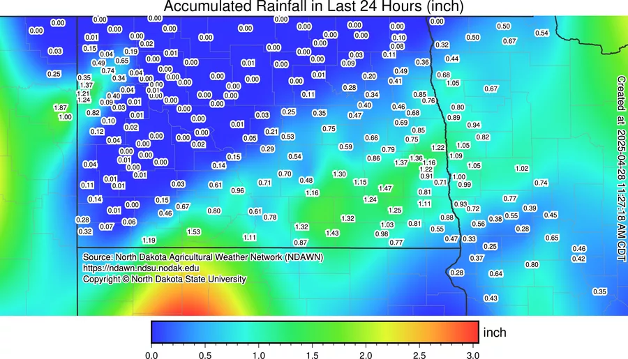
Much of the area picking up around 1.0″ of rain with about another 1/2″ to 1″ additional rainfall expected through the evening. There is a chance for an isolated severe storm in Lakes country later this afternoon, but most of that should stay east of the Valley. In fact, areas around Minneapolis could have a significant severe weather outbreak with large hail and EF2+ tornadoes.
After the early week drenching, another shot at some light showers midweek but then we set the stage for a MILD weekend with highs over the weekend in the 70s:
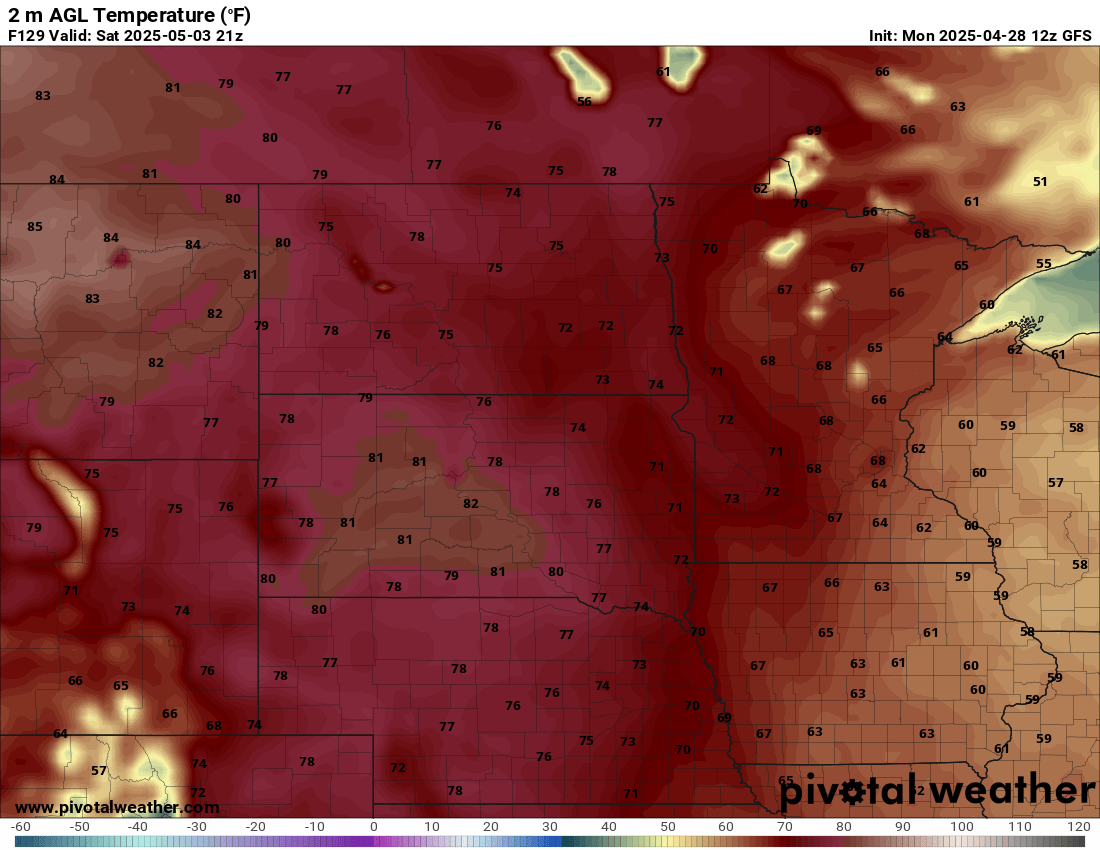
Saturday Highs
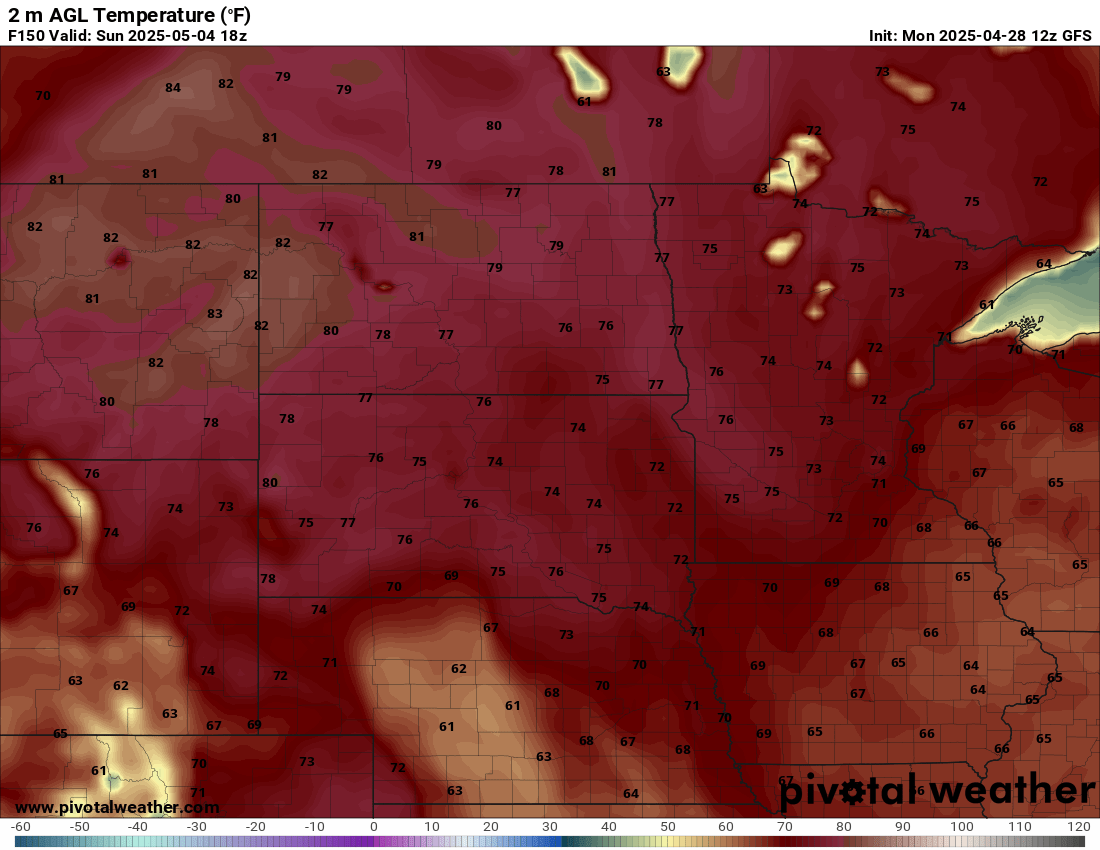
Sunday Highs
Spring is finally here with out last “widespread” frost/freeze likely this week, however, the LRC does bring the poss. of a light frost around the 10th-13th of May.