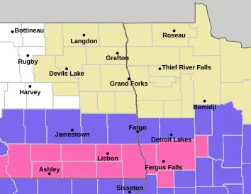
Well, it is still February and more snow is moving in. We need it though as it’s been a less than snowy winter. After yesterday’s near blizzard conditions in the area, another quick moving snow system will push through the area this evening into tonight. Winter weather advisories have been issued for areas along and just south of the 94 corridor with Winter storm warnings for the SE corner of ND into MN:
Here’s a look at snowfall expectations:
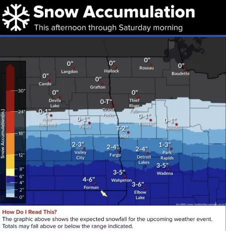
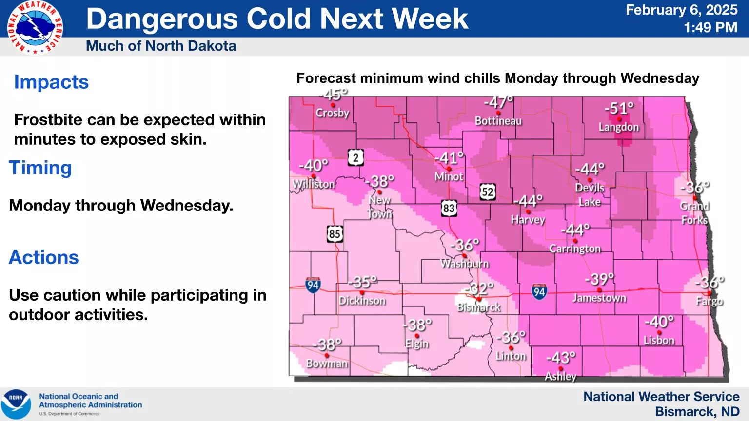
We should see the heavier amounts south of the 94 corridor with little to no accumulation to the north of Fargo. Good news about this snow event, there won’t be the strong winds on the back side of this system with the exception of areas of SD. NW winds on Saturday about 10-20. So blowing snow should not be a major issue. Following the snow, bitter cold settles in next week. Here are some projected wind chills for early next week:
Winter is here to stay this month. LRC is still predicting a possible bigger storm around mid month. Stay tuned: