A winter storm warning is in effect for the F/M area later today through the day on Wednesday

Here’s how it is LIKELY to play out. Snow will overspread the area today from mid morning through afternoon. Snow will fall at a moderate clip into early afternoon before mixing with rain in the Valley while remaining snow to our west/southwest. Areas around Oaks and Lisbon areas are expected to pick up several inches of snow today while the Valley area receives an inch or so of slushy accumulation.
There are some question marks on tonight…..a few of our models “dry slot” the F/M area which means the precip may come to a halt from midnight through 7am. This is NOT a given but it would limit any additional accumulations overnight.
Wednesday looks to be a MESS. Snow will increase throughout the morning and be heavy at times throughout the day with additional accumulations of around 4-7″ of snow in the F/M area with higher amounts to the west/southwest of the Valley.
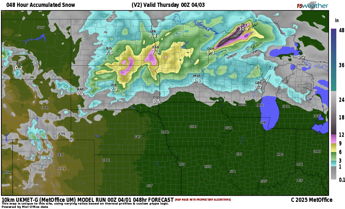
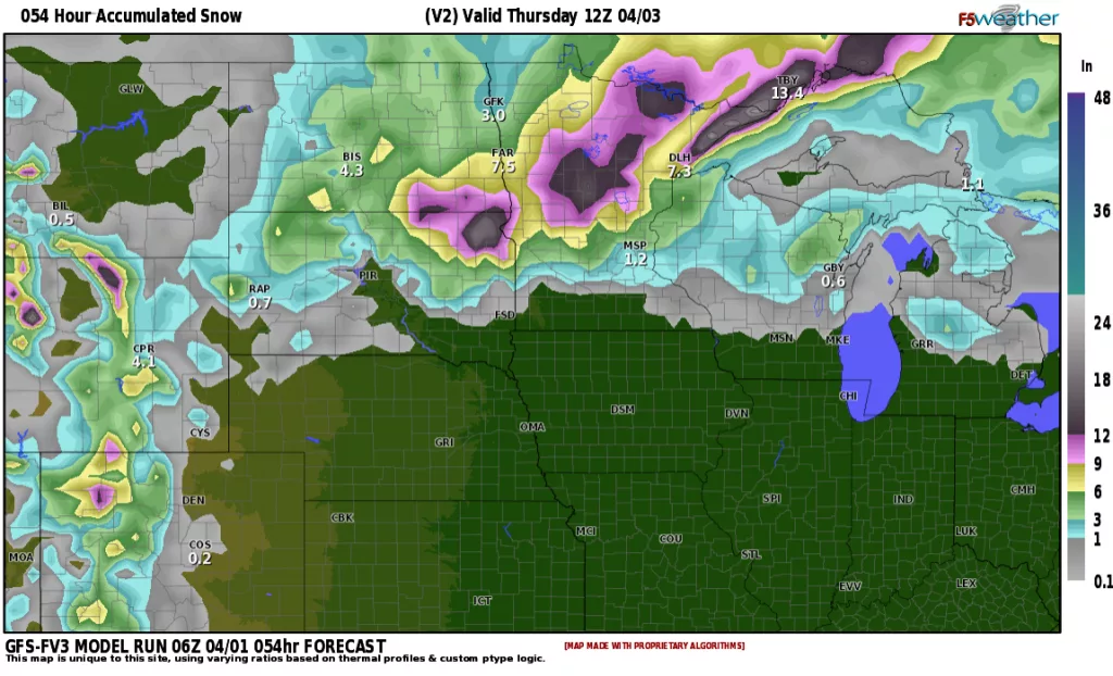
Courtesy: f5 weather
Right now, current thinking is the majority of this storm hitting hard Wednesday with 4-7″ of snow in the F/M area and up to 12″ or more SW of the Valley. Stay tuned as our morning model runs coming in will update on expected snowfall totals.