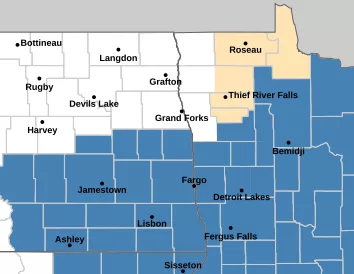
Winter storm watches have been issued for much of the area and will likely be upgraded to warning criteria in the southern valley and into Lakes country. A strong area of low pressure will be riding out of the rockies and into the N. Plains with a swath of heavy snow.
Snow will start Tuesday with a swath of warm advection snow pushing into the area from the south during the afternoon. Some of the snow may be heavy to the west and SW of the Valley. In the Valley, rain may mix in and this would limit totals but that is not certain. Snow will continue through midnight and then we see a small break in the precip before snow, wind and cold commence on Wednesday with snow continuing through the day with WINDY conditions by afternoon.
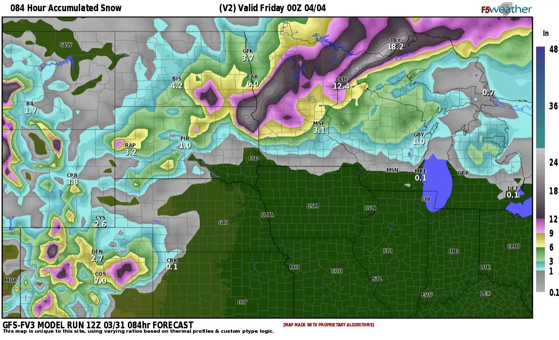
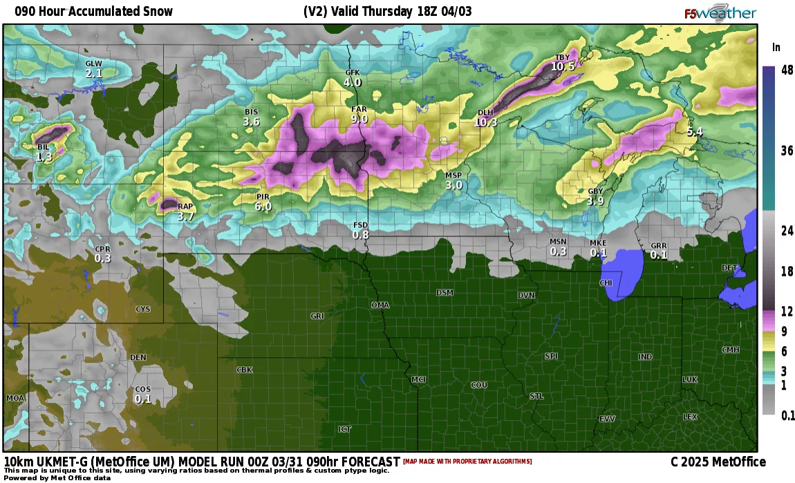
Here’s a look at a few models predictions:


What most models are agreeing on is the HEAVIEST snow will fall from the far southern valley into lakes country where 8-12+ inches are likely. In and around the F/M area around 4-8″ likely with lesser amounts to the north. The wild card will be how much rain do we mix in with the snow on Tuesday into Tuesday evening. A slight shift in the track of this storm will change snowfall totals quite a bit AND how much rain mixes in. All big question marks right now. If you have any travel plans on Tuesday afternoon into Wednesday, please keep up to date on road conditions as this storm has the potential of being the biggest on of the year, so far.


