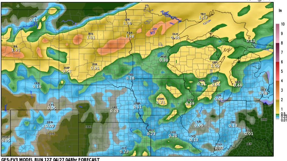
It’s been a DRY start to the LRC cycle this fall but NOW we are entering a brief “stormy” part of the LRC cycle which will bring us some much needed rain over the next week. First off, storm #1 which is bringing some heavy snow to Colorado and some much needed rain to the central and Northern Plains.
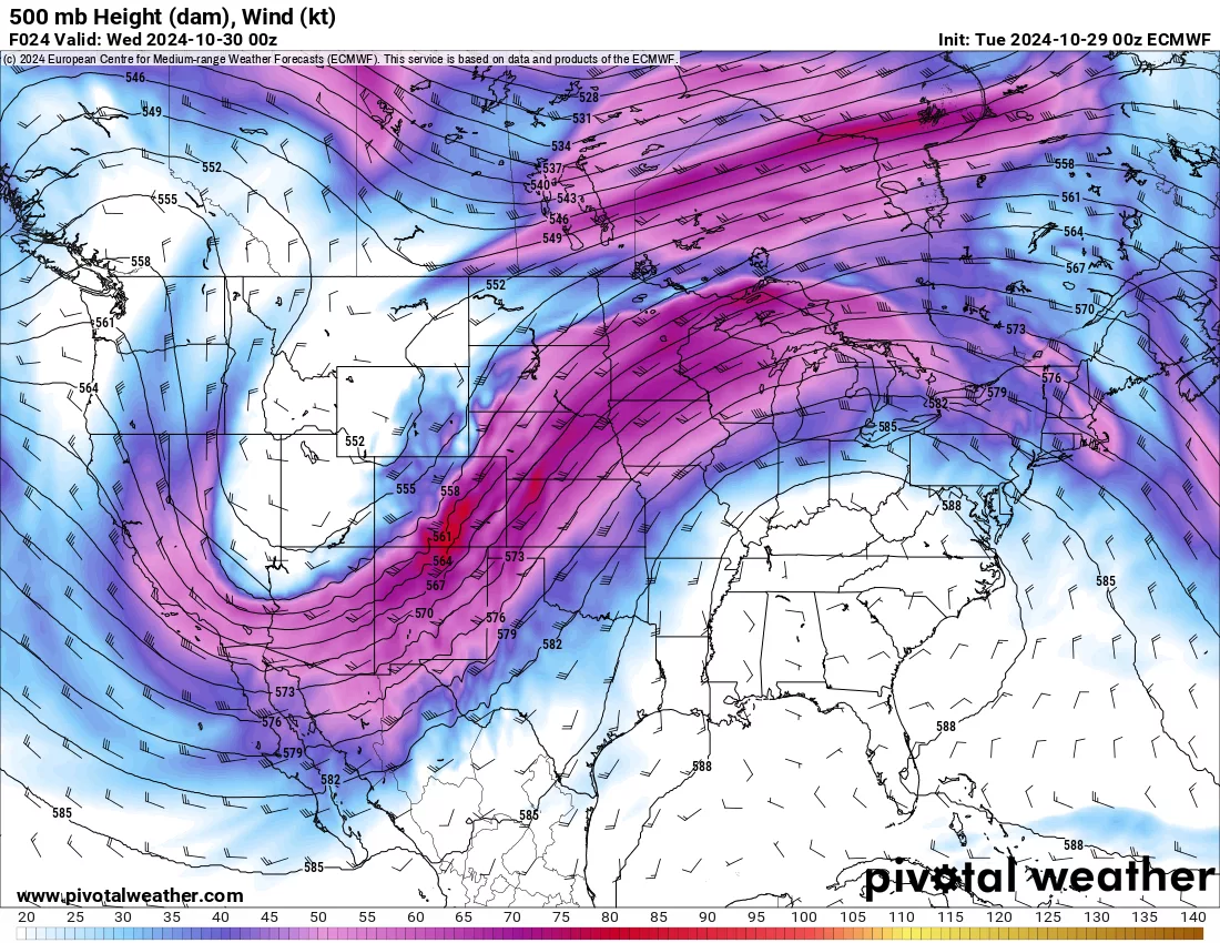
The big DIP in the jet stream out near the 4 corners area is a strong upper low which is expected to drop copious amounts of rain and snow to the central U.S. In fact take a look at some of these totals:
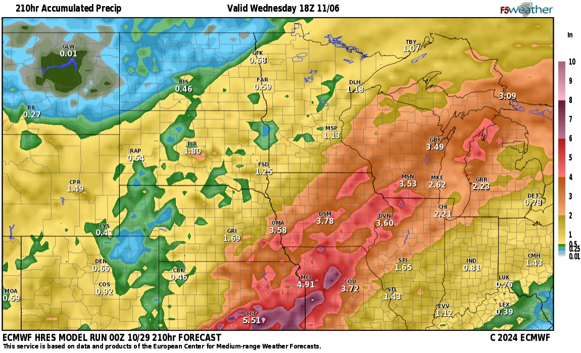
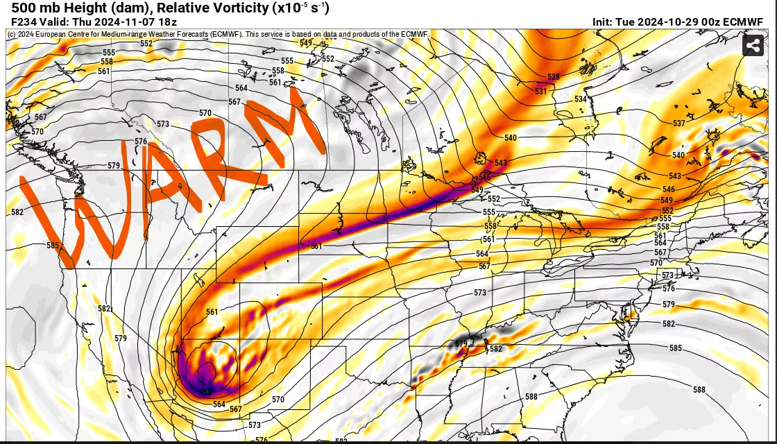
Some pretty impressive rainfall totals for sure with the 2 storms coming into the area…..BUT…..that’s not going to last long as a big push of warm air will enter the western U.S. around the 10th of Nov. flooding the central plains with above average temps once again:
We don’t know the length of the LRC cycle YET, however, it’s a good sign to see a few storms rolling though the country already. I am a bit concerned about the continued return of warmth throughout the early/mid part of the LRC cycle this year. Stay tuned……