It’s been dry around here and we are in need for some moisture. Outside of a few minor rain events this month, there’s been nothing of note as we transition from fall into the early signs of winter. The new LRC cycle is about 2 weeks in and it’s starting to show that the start of each cycle will likely start out with above normal temps and below normal precip. Will this last throughout the rest of the cycle and give us a warm and dry winter or will it turn “stormy” for the back half of the LRC cycle. We will see what happens over the next 3 to 4 weeks. That will tell us a LOT about how this upcoming winter will unfold.
Next week is showing some promise as our models are hinting at a possible storm around midweek. However, there is a LARGE difference in our long range model solutions. First let’s take a look at the European model for next Tuesday:
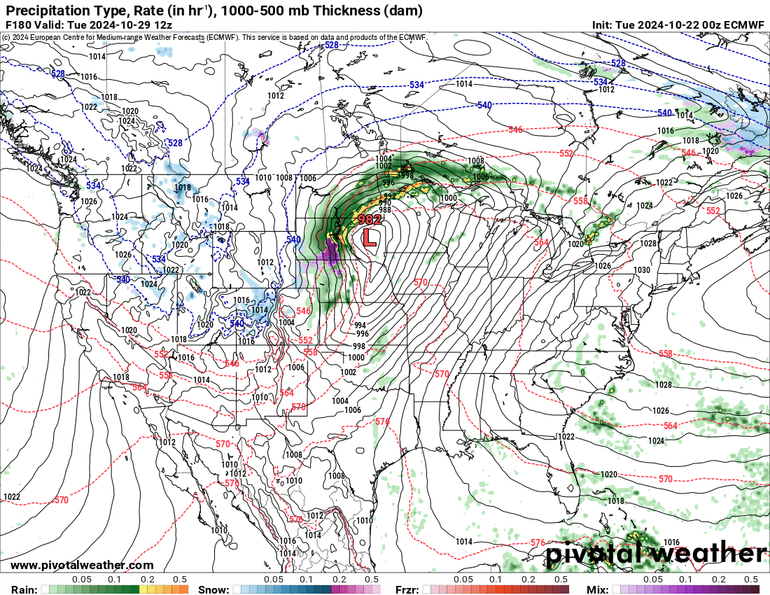
Note the 982 area of low pressure. This translates to about 29.00″ on your home barometer. That is a STRONG storm system. Now look at the HUGE difference by our American Model:
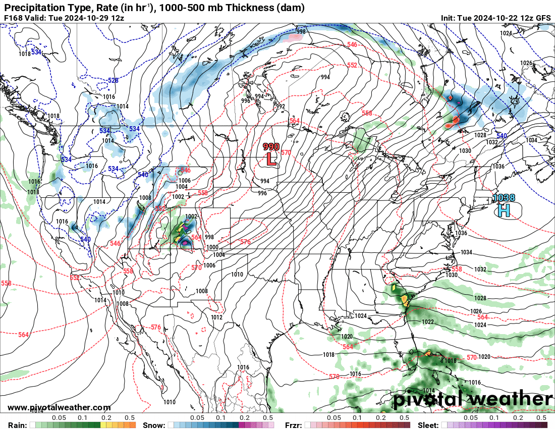
The GFS model has more of an open weaker area of low pressure. As we get closer to the event next week we will be able to iron out the details. Let’s hope the European model is on to something as that would give us a better chance for more widespread precip.