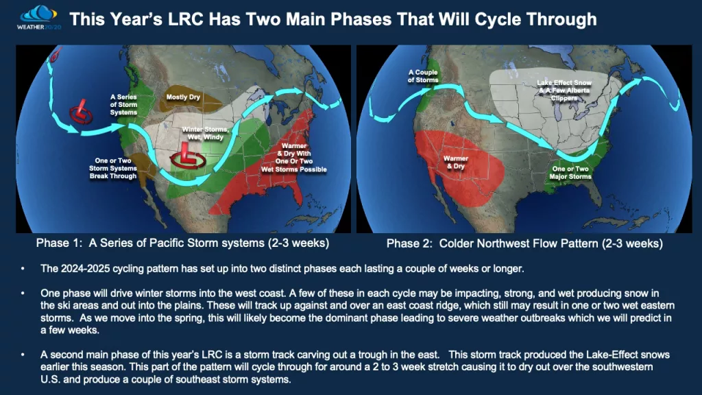
The LRC cycle is now set. We know the “average” length of each cycle and can time out the storms heading for the N. Plains and the rest of the country. There are 2 distinct patterns within each cycle. There will be a “wetter” than normal pattern and a “colder” than normal pattern.

Here’s a perfect example of the LRC cycle and how it works. Here’s how the pattern that set up in early October looked like:
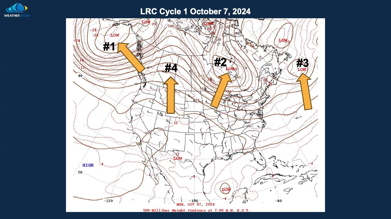
The map above shows October 7th, and then this map below shows that the weather pattern has cycled back through on November 20th. And, then the following map shows a forecast of the weather pattern for around January 2nd, three to five days before a potential major winter storm forms.
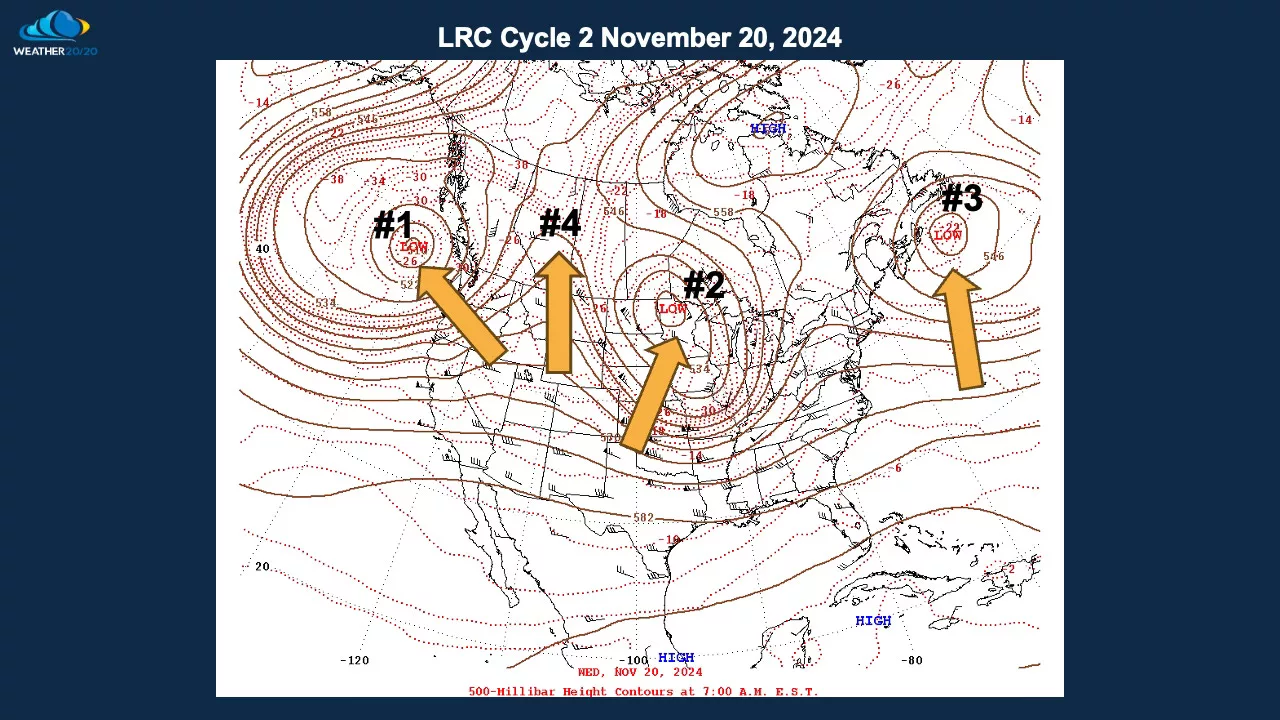
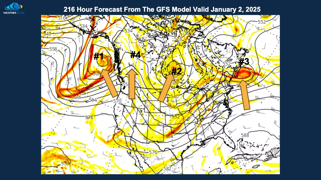
The similarities are remarkable and shows you HOW the LRC cycles!! It truly is amazing!!! We now know that according to the LRC, after Jan. 6th (possible MAJOR storm in the midsection of the country) the Arctic opens up with DANGEROUSLY COLD air entering areas east of the Rockies. For our area, outside of a couple of clippers as the Arctic air arrives, no BIG snow events in the foreseeable future. The only “wild card” would be IF the storm that develops in the Central/Southern Plains around the 6th of Jan. pulls a little farther north into the N. Plains. I’m only seeing that as about 20%, however.

