A weak weather system will be moving through the area today into early tonight but snowfall amounts look to be light. Here is a look at 4 different models snowfall predictions:
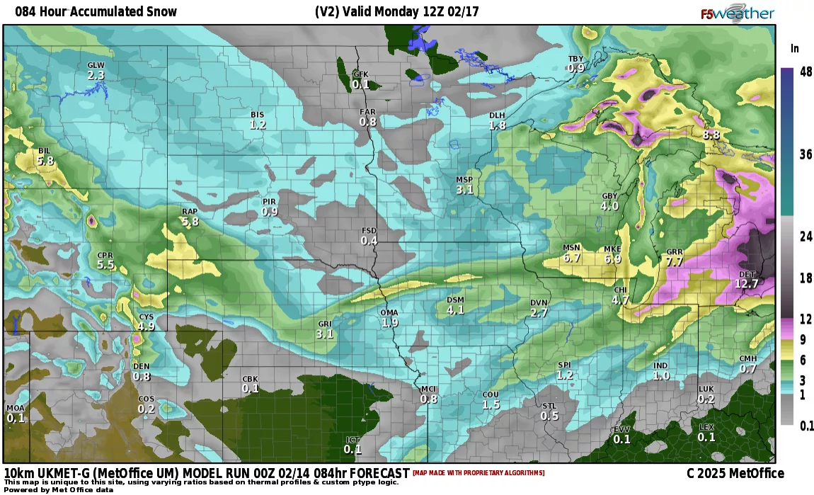
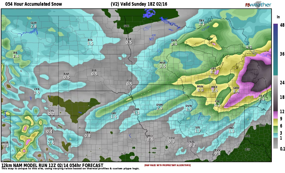
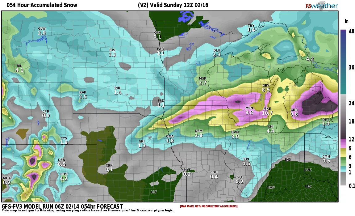
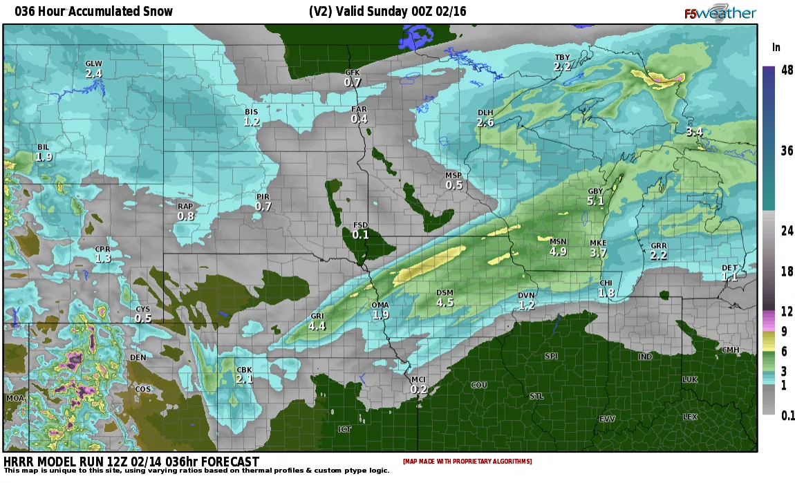
Courtesy F5 weather
As you can see, not alot of snow with most areas 1/2″ to 1″
Bitter cold weather will once again settle in with dangerous cold weather for the start of next week….BUT…..toward the end of next week we start to see a shift in the pattern. LRC has predicted after the 21st, we go into “phase” 2 of the LRC cycle:
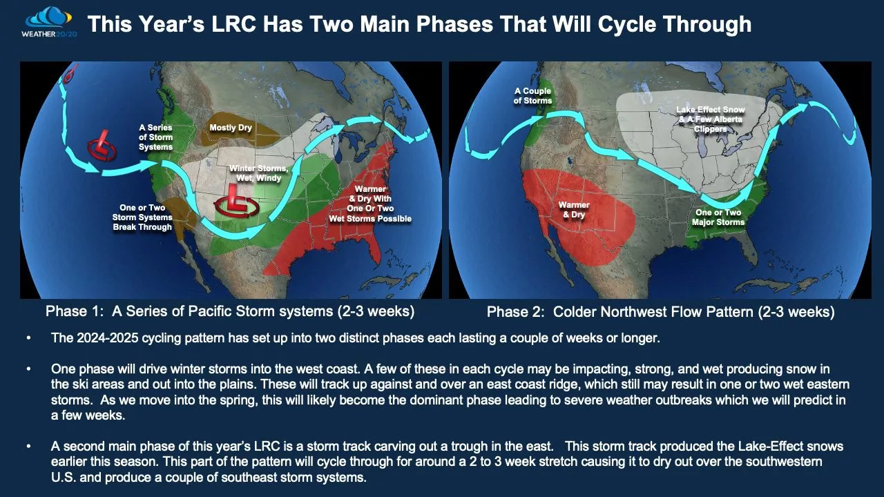
Courtesy: weather2020
Phase 2 will bring us a “rollercoaster” ride in temps with numerous clipper systems “warming us up” then “cooling us down” but we get rid of the constant stretch of Arctic weather. Mark you calendars for mid March as the stormy part of the LRC cycle will likely return to the N. Plains…..assuming the Arctic Oscillation doesn’t turn sharply negative again (dragging down bitter air from Canada) Stay tuned…………..