
Torrential rains targeted Bismarck Mandan yesterday with reports of locations seeing 2-5+ inches of rainfall over a short period leading to streets turning into rivers and vehicles in and under water.
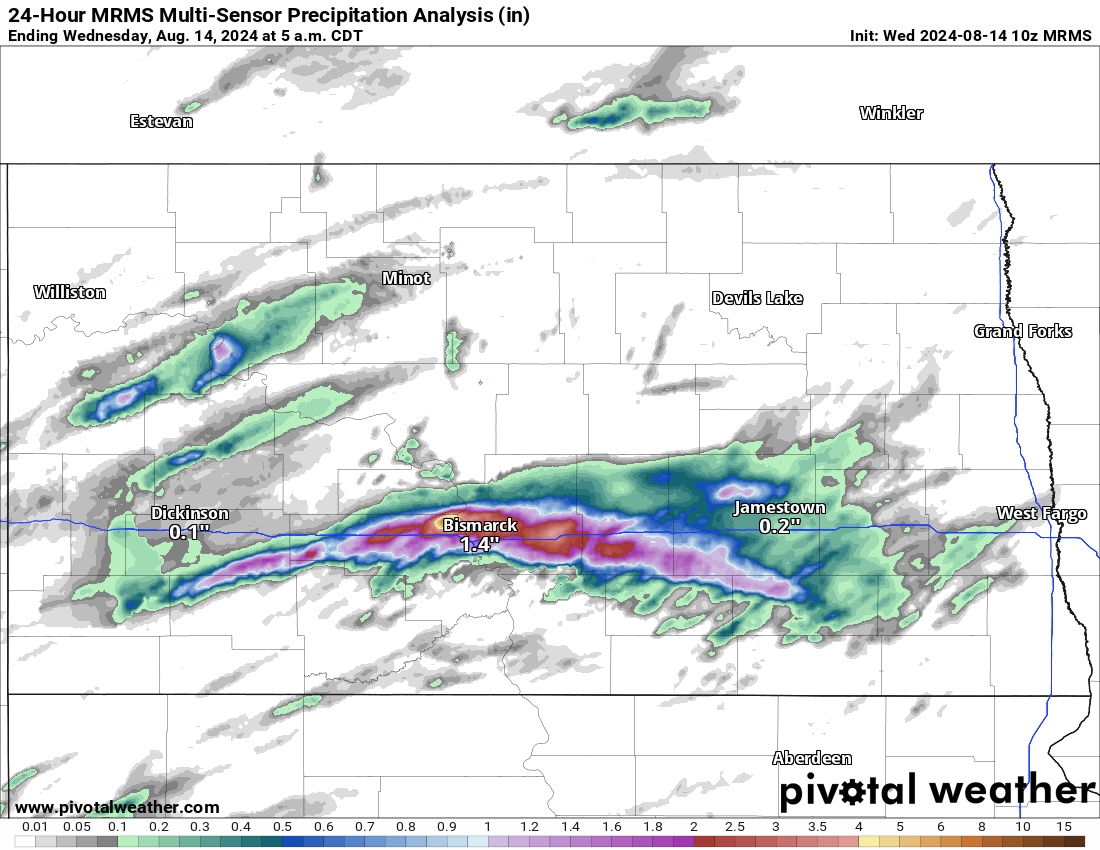
24-Hour MRMS Multi-sensor Precipitation Analysis ending 6:00 am CDT 8/14/24 via Pivotal Weather
Slow moving storms with heavy rain sat over the Bismarck Mandan area on Tuesday 8/13/24 causing flash flooding across the city and area. Numerous reports of flash flooding and streets turning into “raging rivers” have been coming in and additional rains are still in the forecast for the region.
Flash flooding is extremely dangerous!
It only takes a relatively small amount of water to carry a car away, often with catastrophic consequences.
I’m thankful to everyone driving in Bismarck this evening who wisely decided against trying to ford the waterlogged roads pic.twitter.com/tbpuv7GMfY
— Jonathan J. O'Konek (@JonathanOkonek) August 14, 2024
Flash Flood Watches remain in effect for the rest of the day today Wednesday 8/14/24 for portions of Central North Dakota. Slow moving rains and storms may produce rain rates approaching two inches an hour again today.
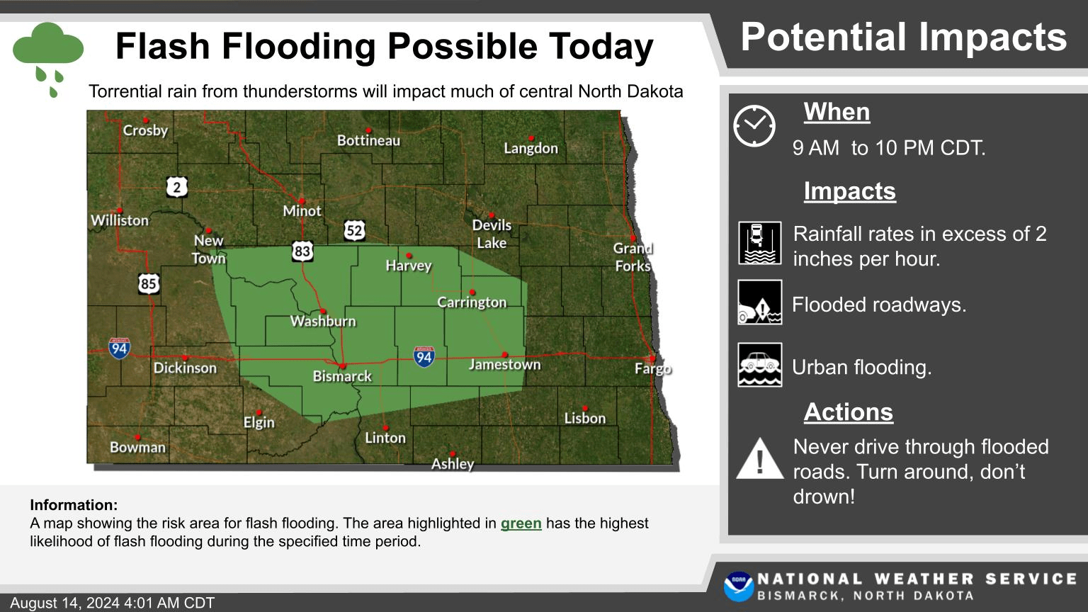
Flash Flood Warning issued for 8/14/24 via National Weather Service Bismarck, Nd.
Although Eastern North Dakota is not in a Flash Flood Watch, the potential for heavy rain may cause localized areas of flash flooding if higher rainfall amounts fall over a short amount of time. For Eastern North Dakota and Western/Northwestern Minnesota, I expect more showers and storms through the afternoon into tonight with additional showers and steady rain on Thursday. Here is one short range model on estimated Precipitation through Thursday afternoon. Although this model does indicate less rain around Bismarck, I would consider it to be in a one to three inch range like the rest of the area. Again keep in mind this is only a model estimation, some locations may see less or more rainfall but you get the general idea, heavy rainfall is possible across most of ND, MN, and Eastern SD.
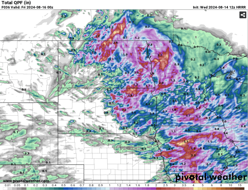
8/14/24 12z HRRR Estimated Precipitation via Pivotal Weather
Meteorologist,
Justin Storm