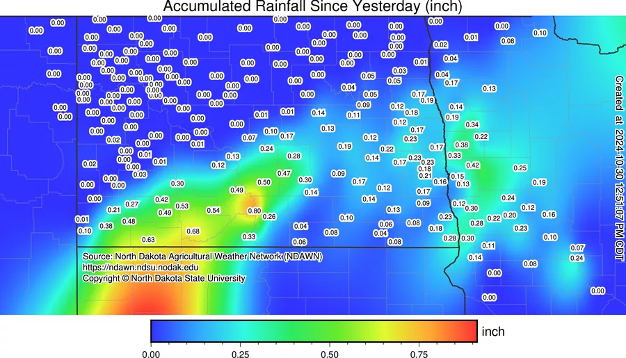
We all know how dry it’s been around here after a record dry September and start to October. Any rain we get is appreciated and last night’s rain wasn’t a lot but every little bit helps
Now we have temps dropping to “seasonal” levels for the next few days with little to no precip in the forecast. However, another storm is coming our way for Sunday-Tuesday. THIS one could be one of the signature LRC storms that we deal with later in the winter with quite a bit of snow but this time around it looks like some much needed rain starting Sunday. Here is a snapshot of Sunday afternoon surface map:
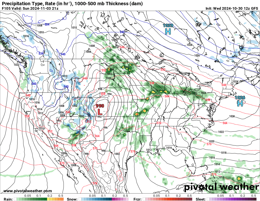
Notice the area of low pressure in Colorado spinning moisture all the way from the Gulf into our area!! Now lets take a look into early next week:
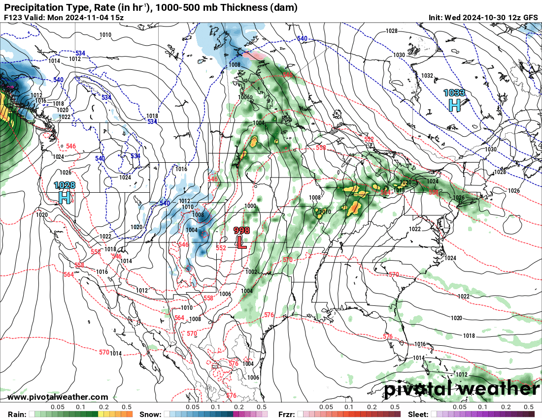
Waves of rain continue to pivot into our area with the area of low pressure slowly moving into S. Kansas….now by Tuesday the storm wraps up into MN :
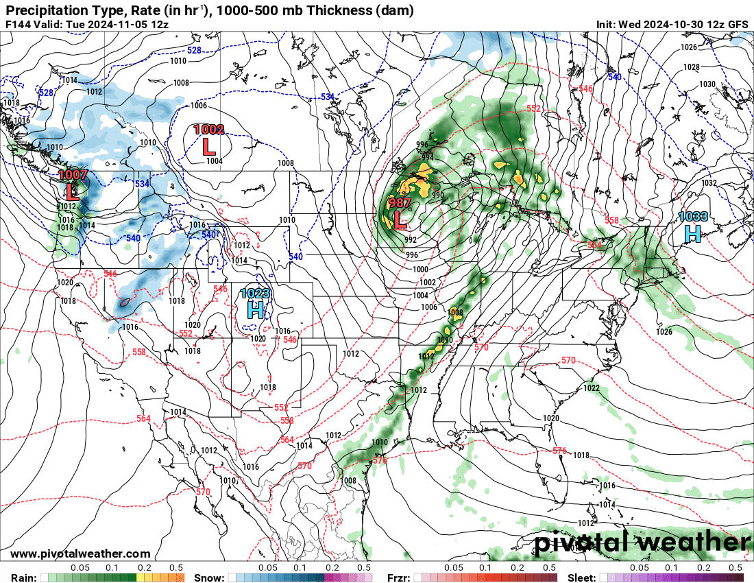
The track of this storm, if it pans out this way, would be a significant snow maker for our area in the 2nd LRC cycle. Let’s see how it plays out. Total rainfall from Sun-Tues could be 1+” for our area. GREAT NEWS for sure.