It’s going to be a Dangerously cold start to the work week with Cold weather warnings (Wind chill warnings) plastered across most of the N. Plains:
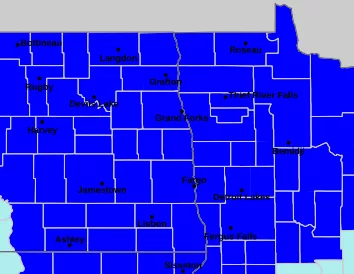
Courtesy NWS
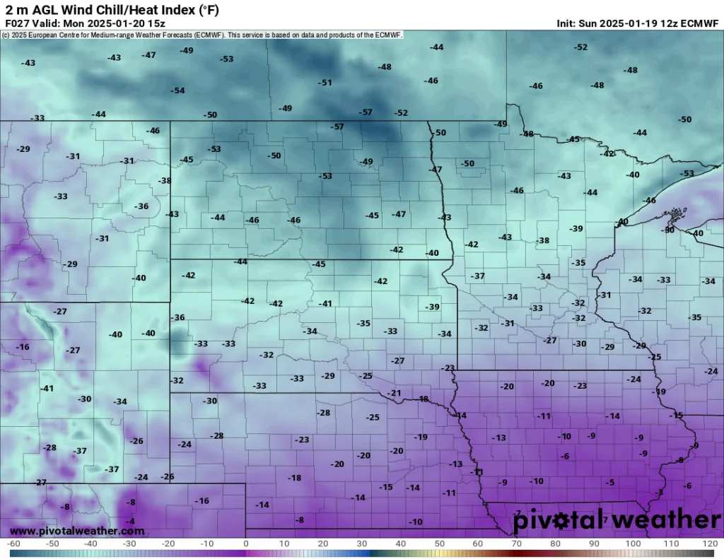
Wind chills are expected to dip to -40 to -53 below zero on Monday morning!!

Courtesy Pivotal Wx
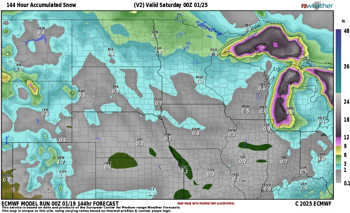
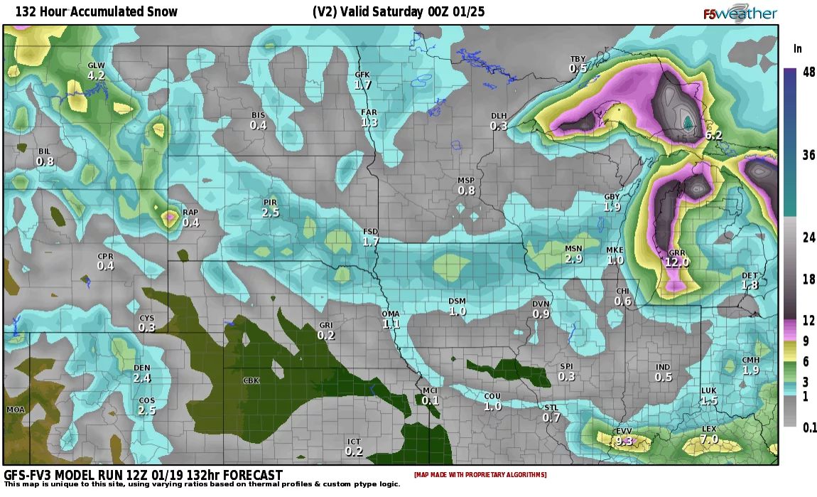
Following the bitter cold start to the week, temps will moderate some throughout the week with a couple of clipper systems coming through the area. Not a lot of snow by any means but by weeks end we could have an additional 1-4″ of added snowpack to the region:
LRC has the potential for a stronger system to start off the month of Feb. Good news is, after the 1st week in Feb., we undergo a pattern change bringing warmer weather into the area.
Chief meteorologist,
Dean Wysocki