I’m sure many are leaving today to make the track down to Frisco. Safe travels and conditions look dry, for today. Things look ok for tomorrow for your travels south if you leave early. Here’s a look at the weather map for Saturday evening: Light snow is overspreading much of Nebraska and N. Kansas into N. Missouri. Freezing rain will impact the KC area and points southward by late afternoon.
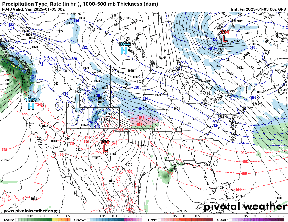
But notice what happens by Sunday morning: Darker blue is HEAVY snow which will be occurring south of Omaha. The purple/pink colors are mixed precip and ICE
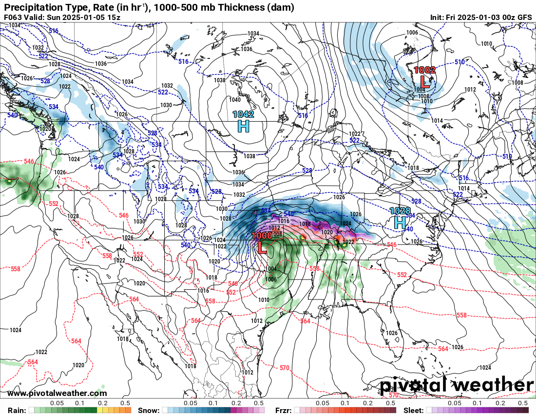
By Sunday evening, the storm is pulling eastward but still snowing heavily around KC. Notice the black lines close together around KC. Those are isobars (lines of equal pressure) and anytime those are close together, it’s WINDY. Looks like a good chance for Blizzard or near blizzard conditions around KC Sunday afternoon/evening.
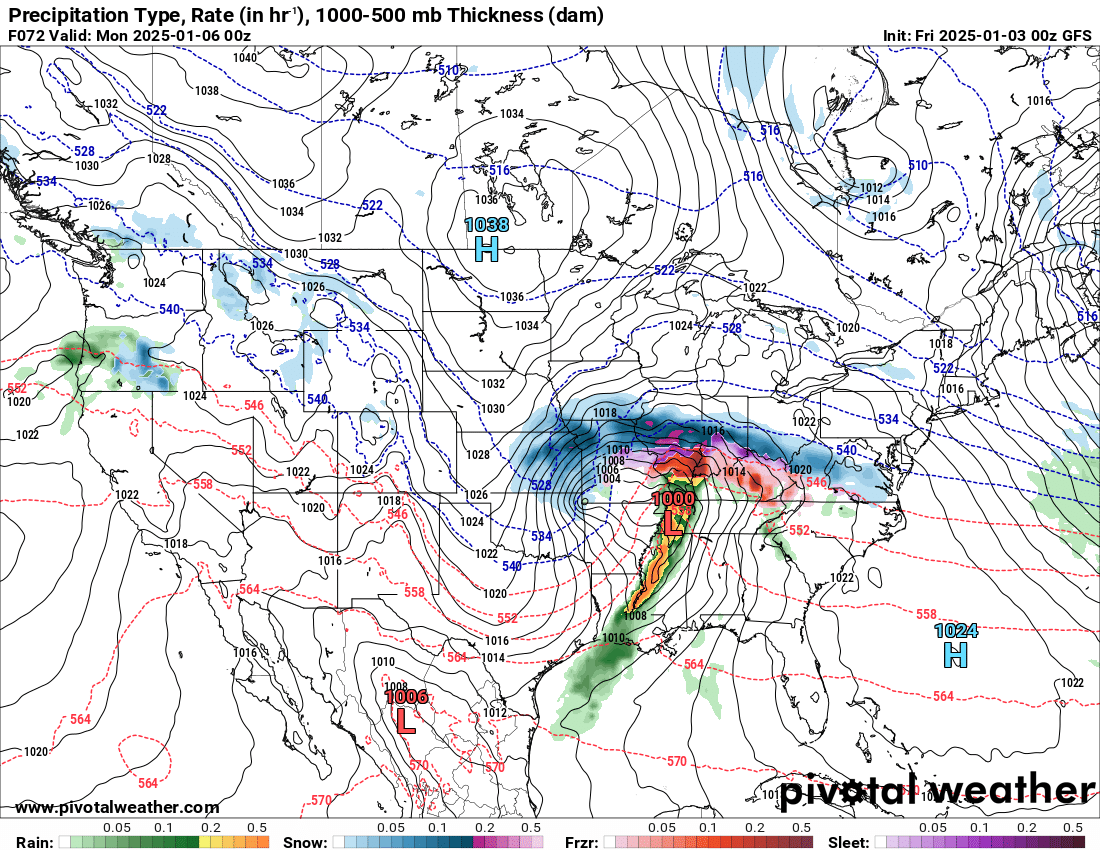
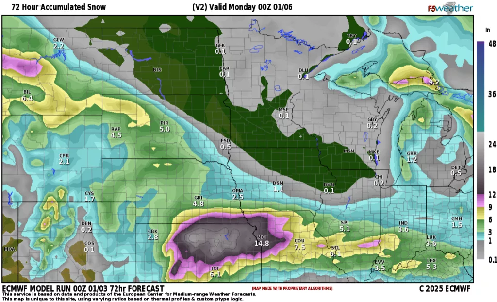
Here’s a look at GFS and European models for predicted snowfall amounts:
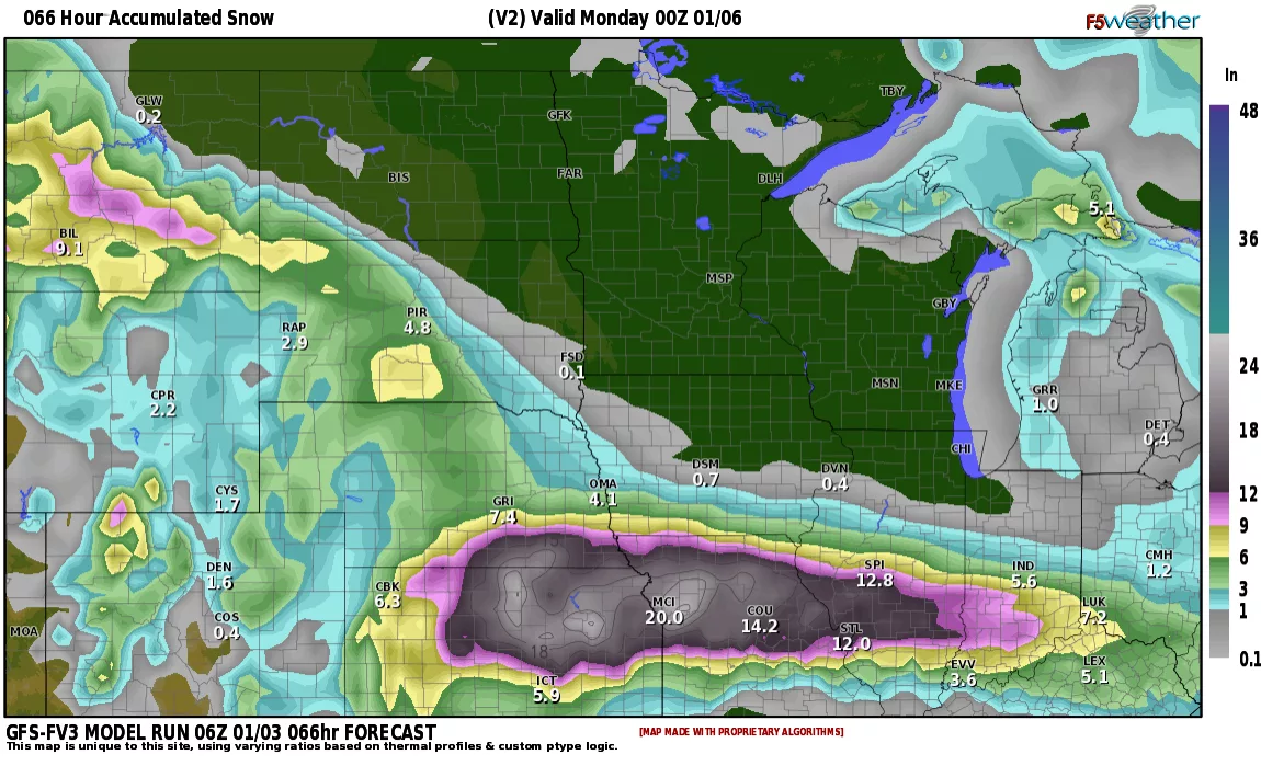

Models tend to over forecast snow amounts in the heavier bands but I thing the European is closest here with amounts around a foot from N. Kansas through N. Missouri.
Summary: If you are traveling on Sunday, be prepared to spend the night around Omaha as roads will be nearly impassible south of Omaha due to snow AND ICE. Monday the storm will be east of the area but travel will still be slick with blowing snow. So, best advice is LEAVE FRIDAY OR VERY EARLY SATURDAY MORNING. Safe travels Bison Nation!!! Kickoff Temp: 37-39 with a NW wind around 5-15.
