Get the wheat harvest and outdoor plans/projects wrapped up over the next day as heavier rains are back in the forecast Wednesday into Thursday!
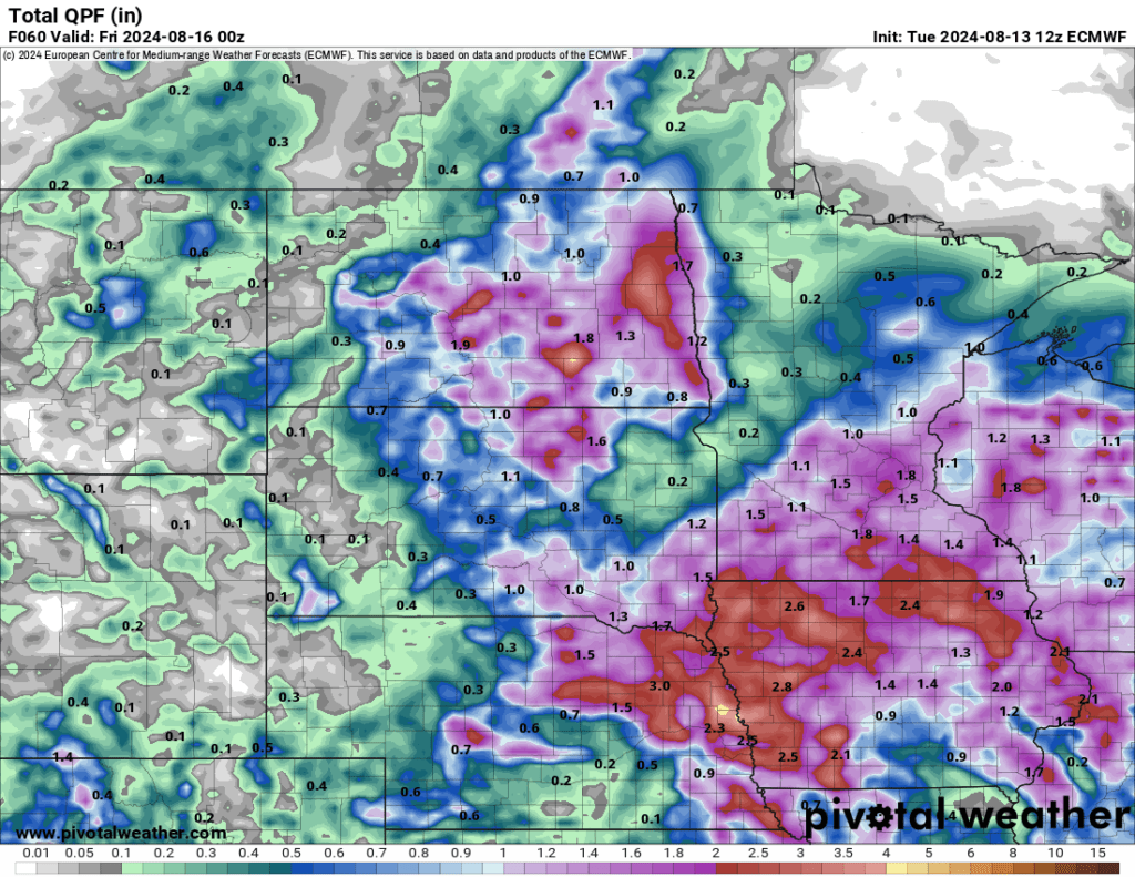
It has been a bit since we have seen a widespread heavy rain event and most of the area could use a good drink to help finish off crops, gardens, and lawns. Thankfully more rain is in the forecast as an area of low pressure brings a good bet on areas getting one to three inches of rainfall with potential for areas to receive more than four.
Overnight Tuesday I expected a cluster of showers and some storms to roll into areas of east central North Dakota pushing closer and into the Valley as we head into early Wednesday morning. We may see a few dry hours Wednesday afternoon here in Fargo and some of the surrounding area before another band of showers and a few embedded storms, to roll through the later afternoon and exit Wednesday night. There will remain a slight chance for additional scattered showers Thursday on the back of the low as it pivots more to the east.
The above featured picture is the 12z Euro model from today on expected rainfall through Thursday 7:00 pm and below is the 12z HRRR model on expected rainfall through Thursday 7:00 am CT. Keep in mind these are model estimations.
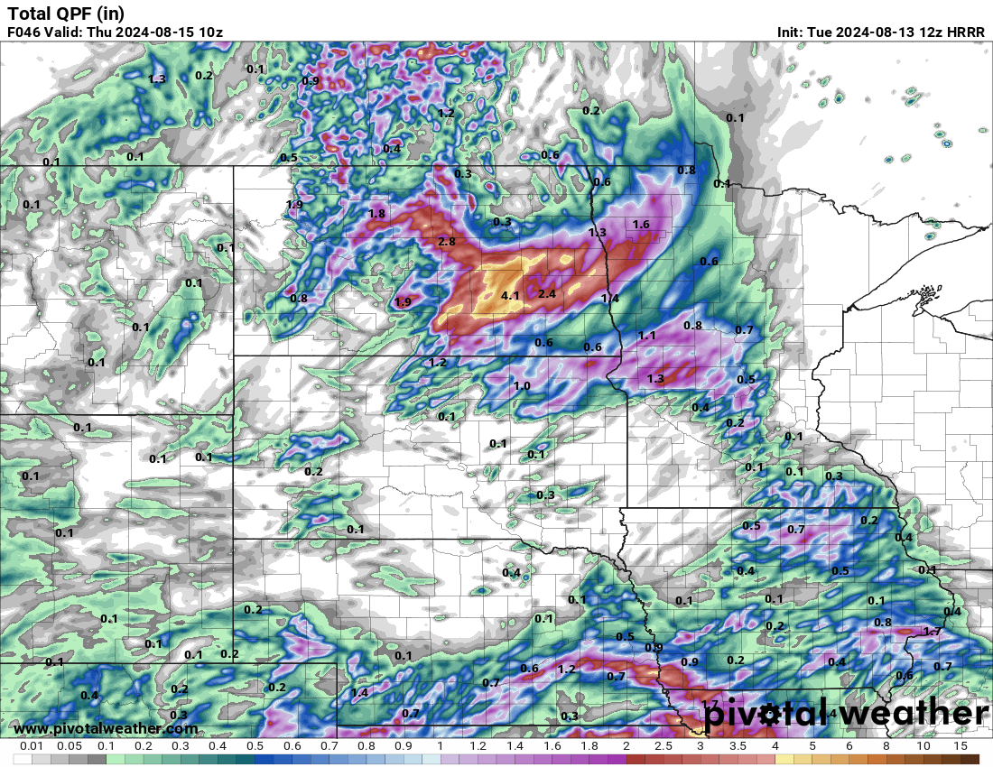
8/13/24 12z HRRR Estimated Rainfall through Thursday morning Via Pivotal Weather
Meteorologist,
Justin Storm
