What in the WORLD is the AO? Most of us know that the LRC is a relatively new weather model used to forecast the weather based on cycling method. The AO is referred to as the Arctic Oscillation and it influences our weather too. Take a look at the latest graphic from CPC (climate prediction center) :
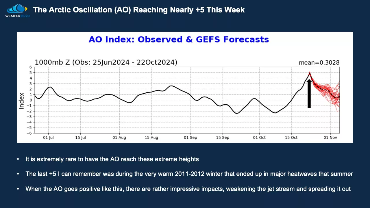
Note the 2nd statement on how the last time the AO was this high was in the winter of 2011-12. We had a very MILD winter with only 2 storms bringing more than 5″ of snow. The snow ended mid March and spring set in with NO snow after mid March. Let’s hope this isn’t the case this winter because that WILL lead to expanding drought conditions. With the AO in a “high” positive range, this leads to weaker storms for our area with not a lot of precipitation:
There are signs of the AO approaching 0 which would tend to energize these storms a bit more and bring in colder air. We will be watching the next 3-4 weeks of signs of wetter weather. Until then, we hope for moisture SOON. If you have any weather questions, feel free to send them to weather@flagfamily.com
Chief Meteorologist,
Dean Wysocki