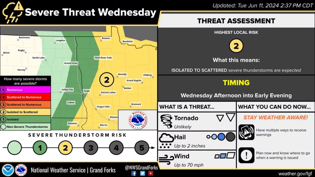
Wednesday will be the hottest day yet of the year for most of Eastern North Dakota and areas of Minnesota as highs build into the 80s to low 90s (a few mid 90s possible). Humidity will also pick up a bit and with warmth and ‘humid’ air instability will grow in the atmosphere. Late Wednesday afternoon a cold front is expected to track across the Red River Valley and into Minnesota through the evening. Along this cold front, storms can develop in the Red River Valley and become more likely and more scattered into Minnesota and southern Minnesota especially.
Hail and wind will be the main concerns for storm threats. Storms will be most likely to develop east and south of Fargo and push into the southern half of Minnesota. Storms will be possible within the Red River Valley and Lakes Country Minnesota. See the above image for the risk area.
Cover photo issued Tuesday afternoon 6/11/24.
You can get the latest risk area here!
Meteorologist,
justinstorm


