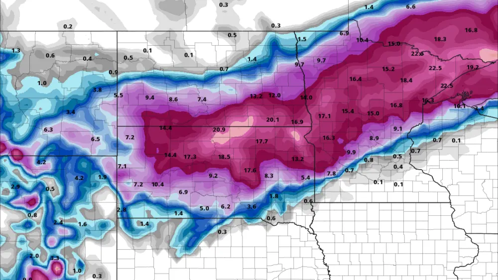
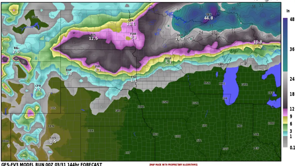
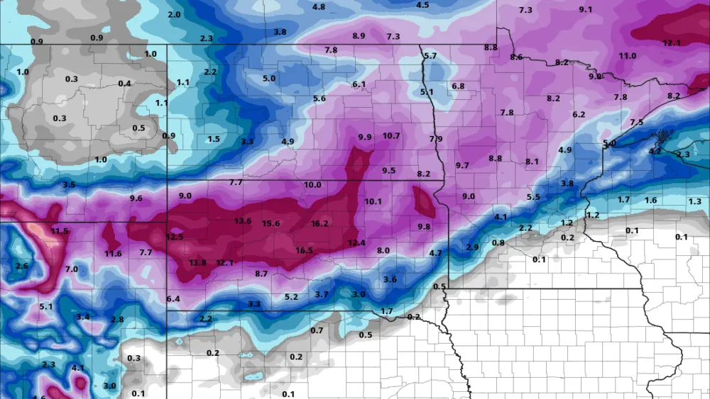
A chunk of cold air is expected to get lodged in North Dakota overnight Thursday into Friday. This air will bring the potential for frost wherever it ultimately sets up, which looks more likely in areas of central North Dakota. Models hint that some mid 30s could try to move into the valley but I’m not sold on that yet. This cold air will be getting pulled down out of Canada on the backside of another area of low pressure bringing another round of showers to North Dakota and Minnesota. Temperatures look to fall into the 30s Friday morning to early afternoon, for where and if this cold air fully sets up… some wet snow may mix in with these rains.
Meteorologist,
justinstorm