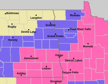
All types of severe weather will remain possible this evening mainly after 6:00 pm. As well as a couple of strong to severe storms possible overnight into early Wednesday morning.
Storms should fire west of the valley in central North Dakota after 6:00 pm closer to 7:00 or 8:00 pm and track into the valley after dark, but a storm or two will be possible before that time frame in central and eastern North Dakota. Storms will push eastward into the Valley after dark and will likely approach the valley around 11:00 pm to 12:00 am (Midnight). Storms should be in a decreasing strength phase as they move into a less suitable environment for severe weather as they track into Minnesota.
Large hail, wind, and an isolated tornado are the concerns with the greatest threat being just west of the valley and in central North Dakota!


