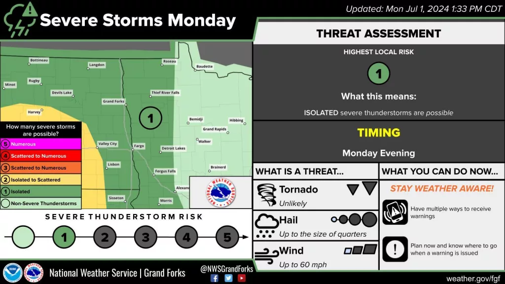
A marginal and slight risk (level 1 and 2 respectively of 5) threat for severe storm potential this evening and tonight in North Dakota and the surrounding area. The main concern for this event would be damaging wind and then hail. As a weak cold front moves across the state this afternoon, storms are expected to develop in Wester ND. These storms will start more singular and have a slight tornadic potential this afternoon then form more into a line moving into Central North Dakota by this evening. Storms will continue to ride along the front from SW to NE pushing into the Red River Valley and Northwestern Minnesota through this evening to around Sunset. Storms will be in a weakening stage as they track through the valley into Minnesota, however, portions of this line will still hold the potential to be on the strong to severe side. Some areas may see heavier rainfall amounts for locations entrained by storms and rains.
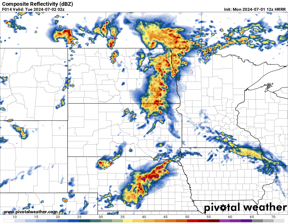
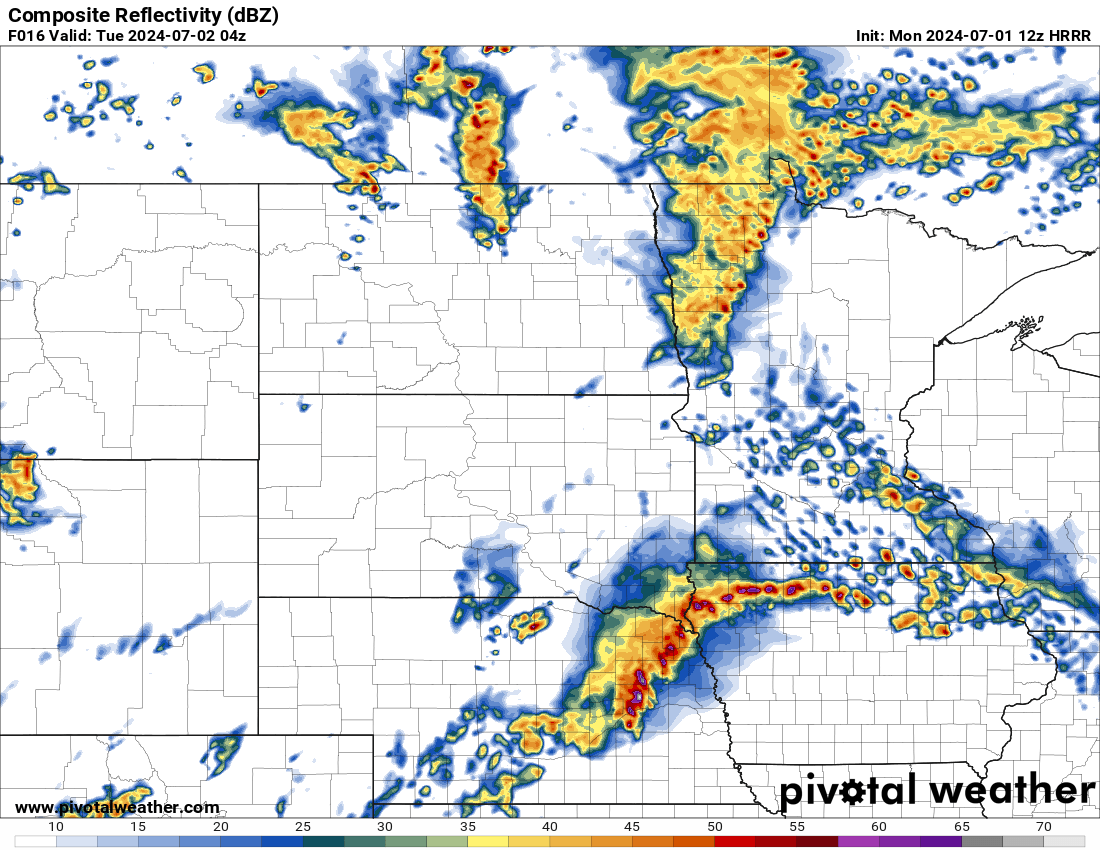
See below images of Simulated Radar from 4:00 PM to 11:00 PM CDT 7/1/24
(This will likely not be exact to what happens)
SIm Reflectivity Radar 7/1/24 4:00 pm CDT
Via Pivotal weather 12z Hrrr
SIm Reflectivity Radar 7/1/24 6:00 pm CDT
Via Pivotal weather 12z Hrrr
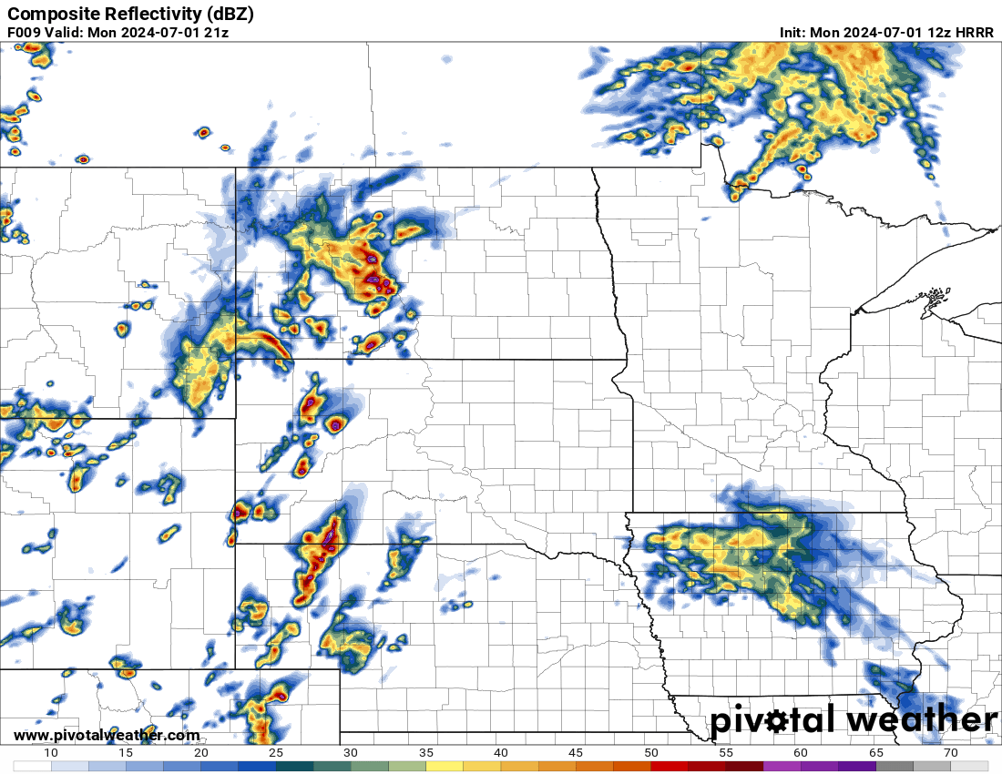
SIm Reflectivity Radar 7/1/24 9:00 pm CDT
Via Pivotal weather 12z Hrrr
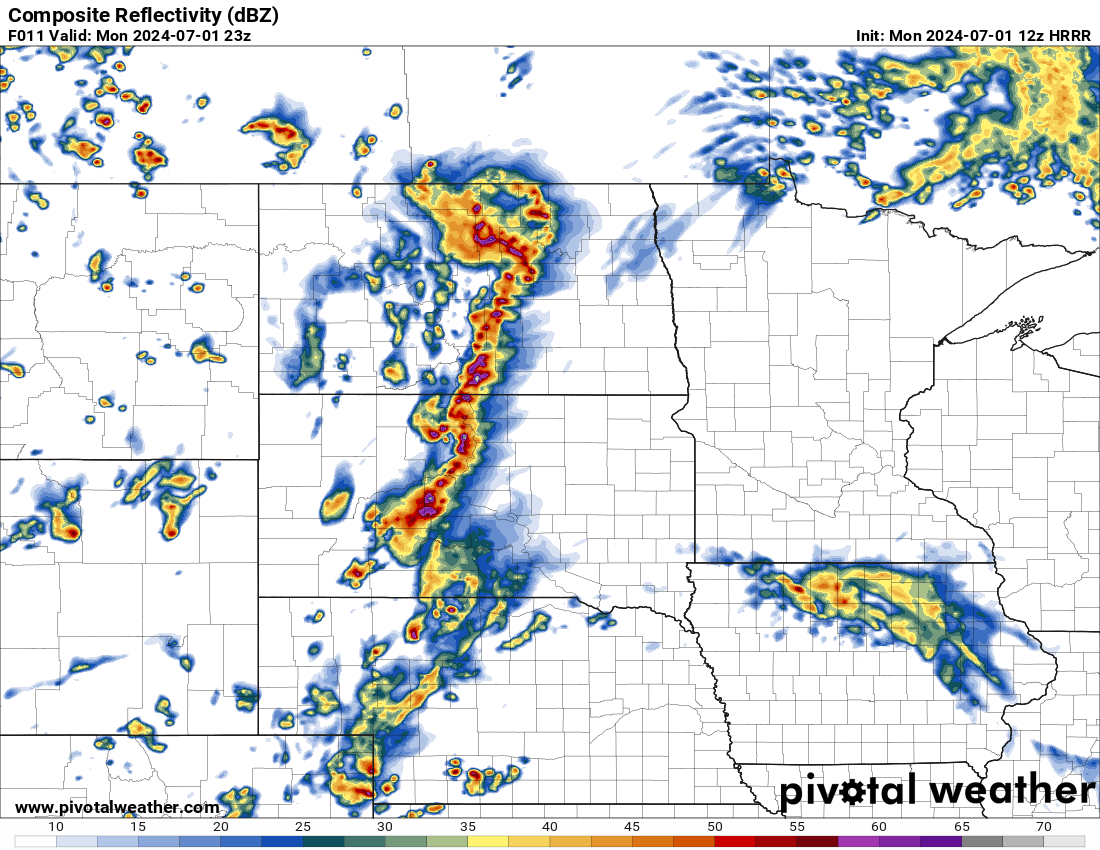
SIm Reflectivity Radar 7/1/24 11:00 pm CDT
Via Pivotal weather 12z Hrrr
Meteorologist,
justin Storm