We haven’t seen a 70 degree day yet this spring. That should change this weekend. We are also expecting some widespread rainfall across the area Sunday PM into Monday.
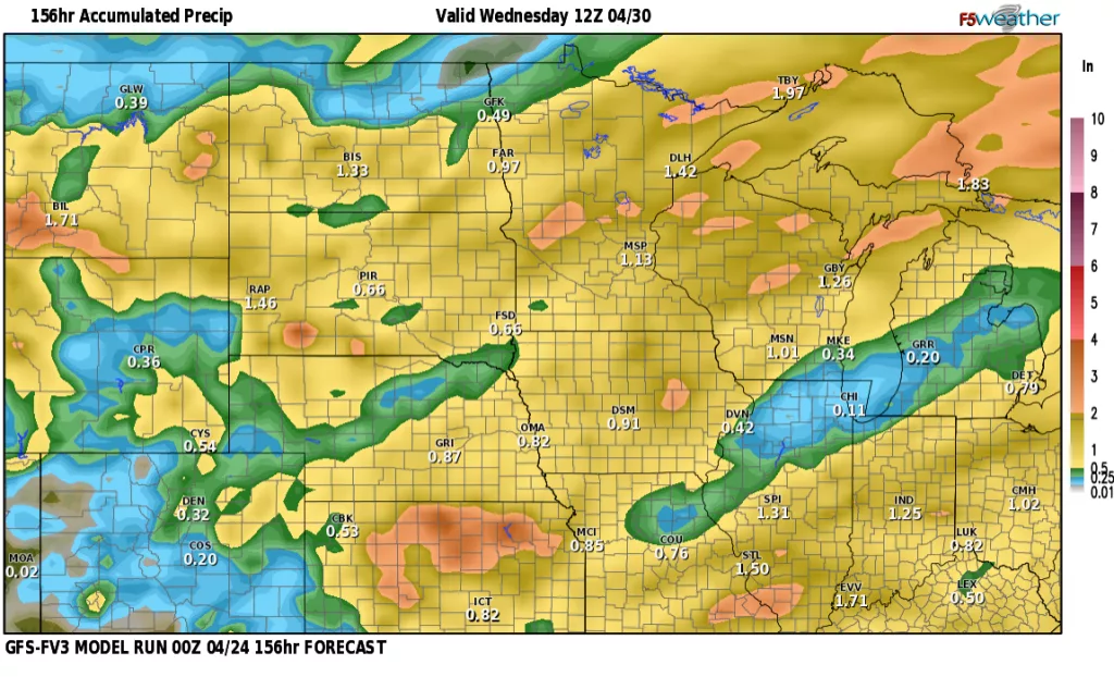
Let’s take a look at how this all shakes out. First off, after a slight chance for a few showers along and south of 94 corridor this evening, we will set the stage for a BEAUTIFUL Friday. Sunshine and relatively light winds on Friday with temps in the mid 60s. As we head into the weekend, winds pick up on Saturday out of the south gusting 30+ mph. As a storm system approaches on Sunday into Monday, some widespread rainfall is expected across the area. Here’s a look at 4 of our models forecasts:
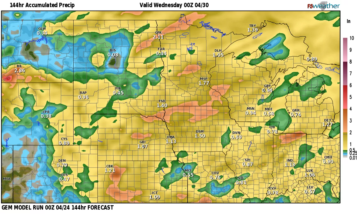
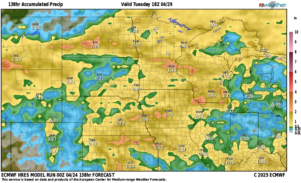
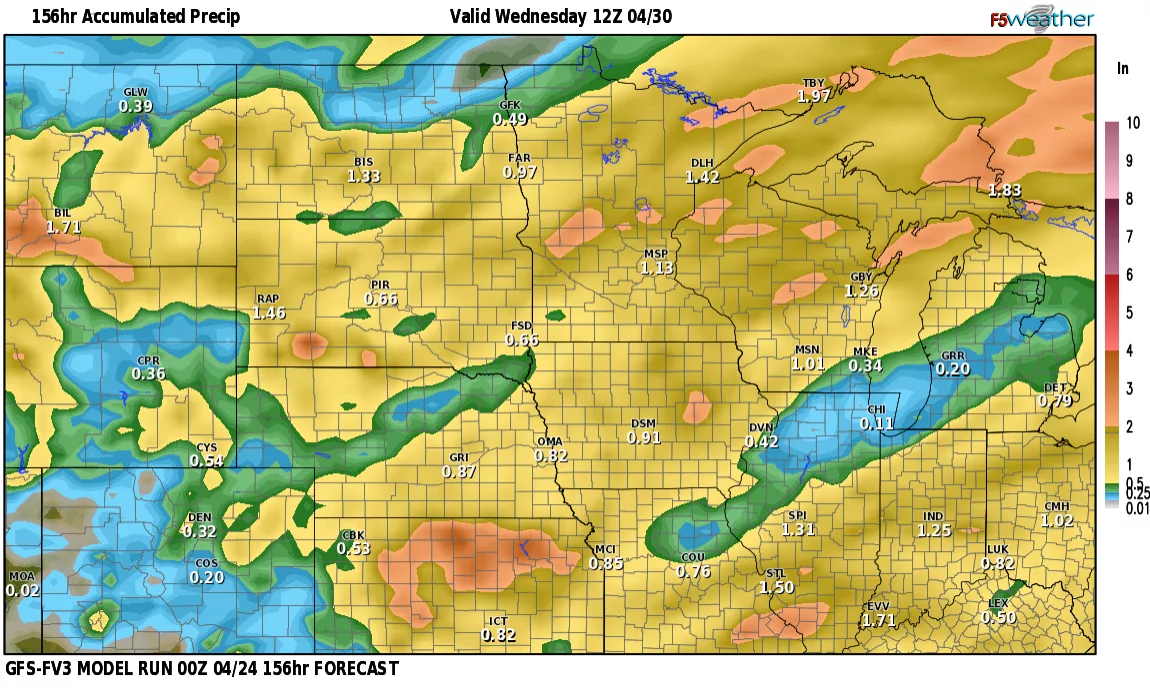
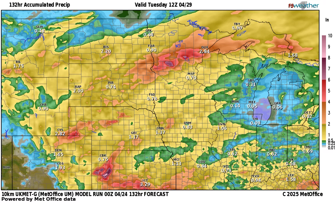
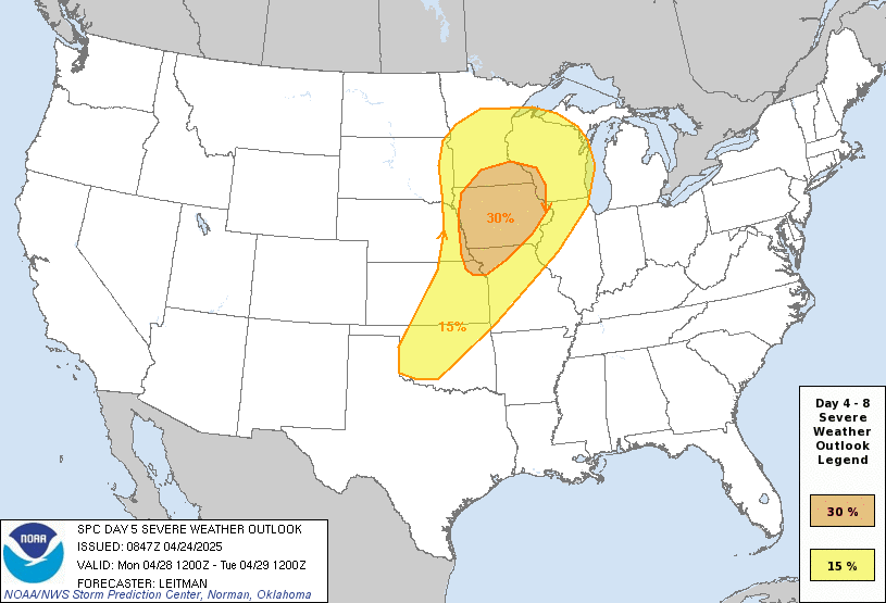
A WIDE variety of precip totals across the state but the majority of the models paint about 1/2″ to 1″ across most of the area and I believe that is accurate. Now, with that being said, there WILL be thunderstorms and any localized thunderstorms could bring heavy rain to some spots. In fact, on Monday, some of those storms could be on the strong to severe side in the S. Valley into Minnesota:
Enjoy the nice weather leading up to this incoming storm. As always, if you have any specific questions, send me your questions at weather@flagfamily.com