BOMB CYCLONE….that’s a term you’re going to hear quite a bit of this week. But what IS a bomb cyclone? It’s an area of strong low pressure that strengthens 24mb in a 24 hour period. Basically, it’s rapid intensification of an area of low pressure.
Before we get to the weekend event, we have some record warmth to deal with today for parts of the area. A strong cold front will be sweeping through the area this afternoon. Out ahead of the cold front, record warmth is expected along and south of the 94 corridor while the far northern valley is stuck in the 20s and 30s. As the cold front swings through winds will increase significantly out of the WNW gusting over 50mph. Temps will drop rapidly this evening to an overnight low near 10. So, we go from record warmth of mid 60s in the F/M area to around 10 above tonight. Crazy swing in temps, but we’re not done yet!
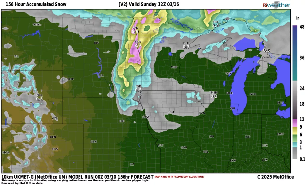
This week has temps from the 30s for highs to the 60s all week. The BIG question though comes late week into the weekend. A strong area of low pressure moving out of the Rockies will bring everything from severe weather on it’s warm side to blizzard conditions on its cold side. Where will the F/M area sit in this storm? Basically, we will lie in both regions. On Friday, we will see rain and a few thunderstorms developing late in the day as southerly winds increase and moisture gets pulled northward. By Friday night, rain will mix with snow/sleet before changing over to snow. The quicker the transition over to snow, the more snow we accumulate. That is the million dollar question…..how much snow? Here is an EARLY look at snowfall predictions from 3 of our computer models:
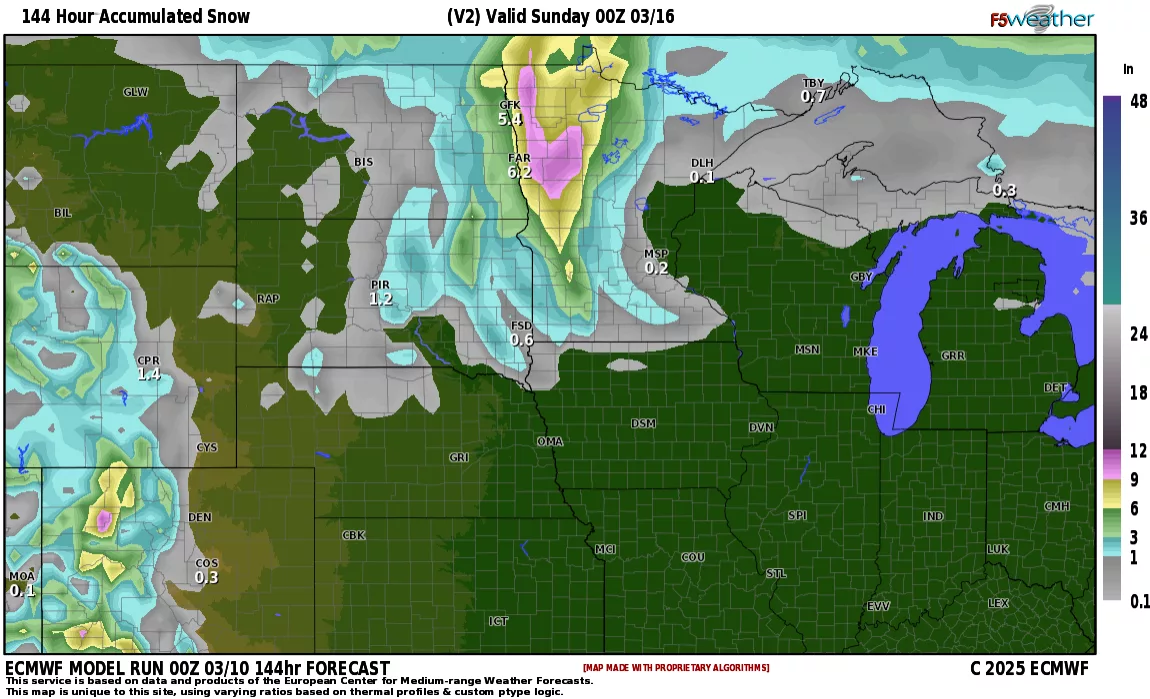
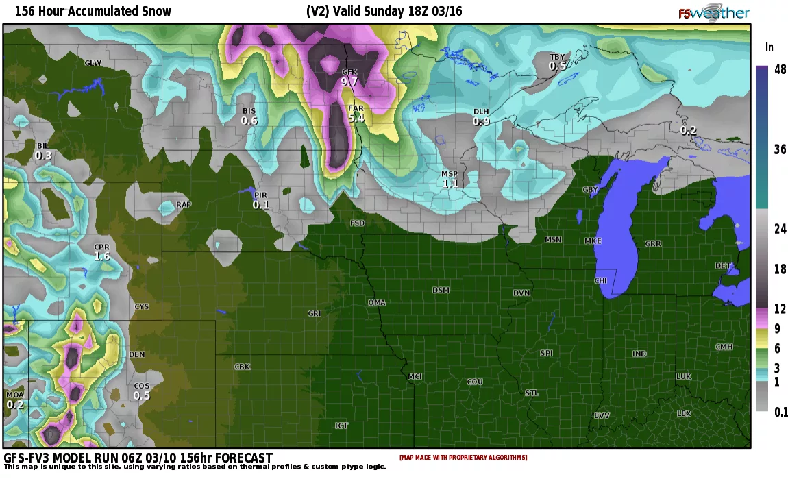

This is snowfall predictions through Saturday night/Sunday AM. Our models will vary in snowfall amounts until the storm comes onshore this week. If you have any weekend plans, which many do because of St. Patty’s day weekend, you may want to have alternate plans. Blizzard conditions will be realized throughout parts of the area on Saturday.
Stay tuned……